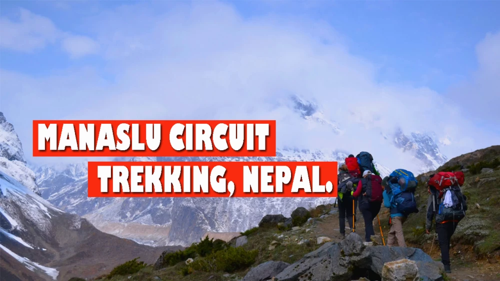
Manaslu Circuit trek in Nepal is one of the most popular restricted off-the-beaten-path adventure journey that is excellent for trekkers seeking an authentic Himalayan experience. It is a perfect alternative to the busy Everest Base Camp and Annapurna Circuit treks.
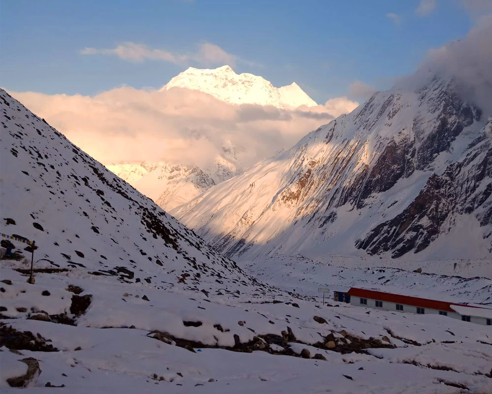
The Manaslu Circuit trek offers incredible landscapes, rich Tibetan Buddhist cultural heritage, jaw-dropping mountain vistas, and a peaceful journey. Traversing varying terrain and altitude, you will reach Manaslu Base Camp, the lap of the 8th-tallest mountain in the world.
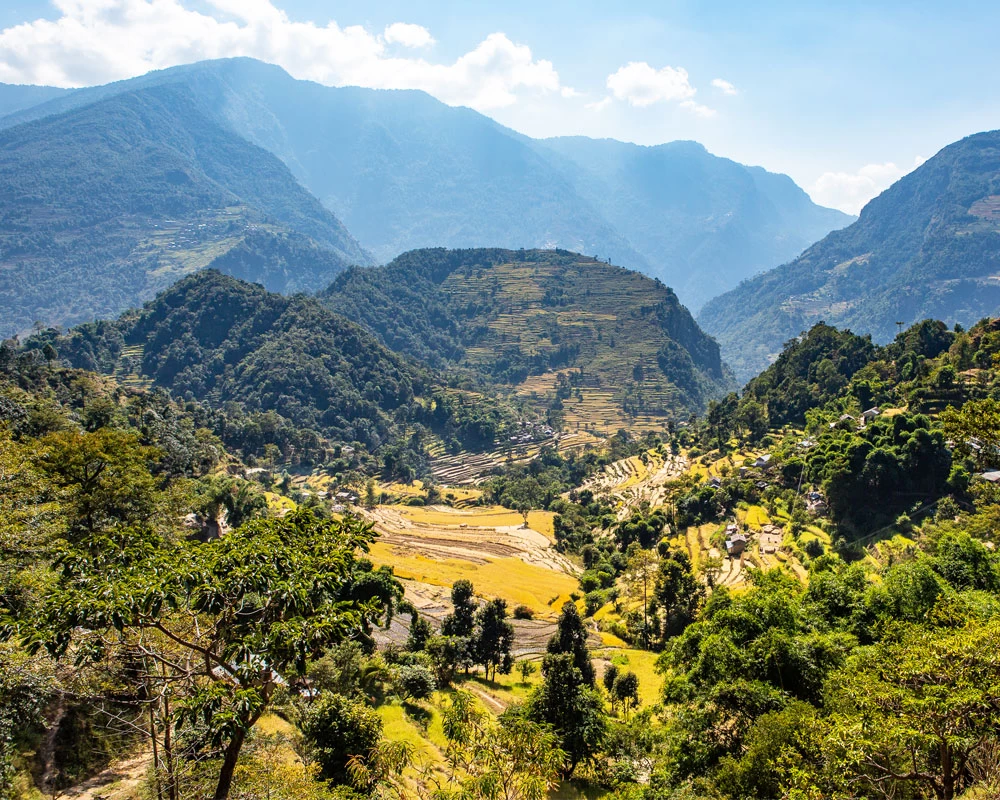
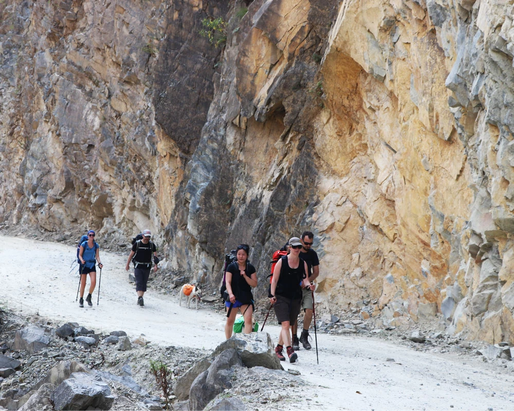
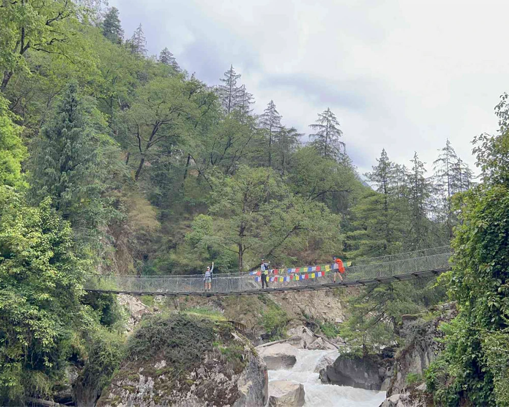
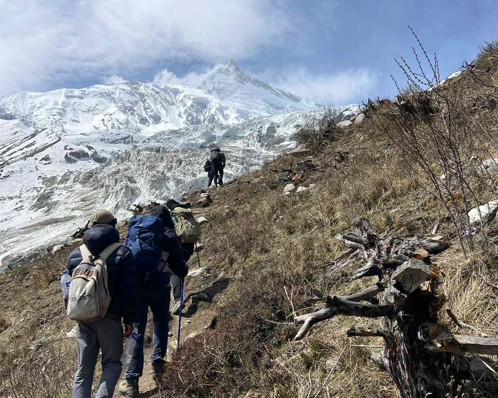
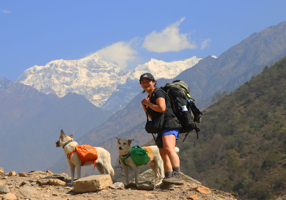
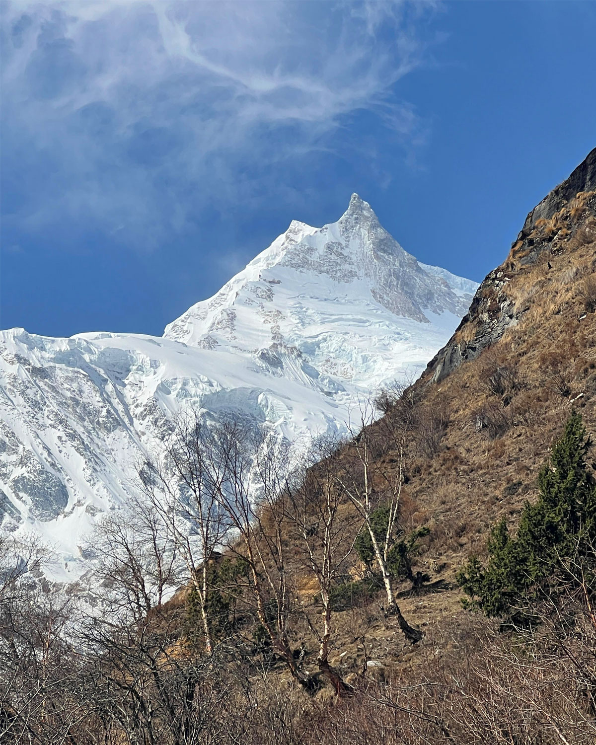
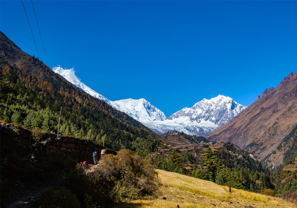
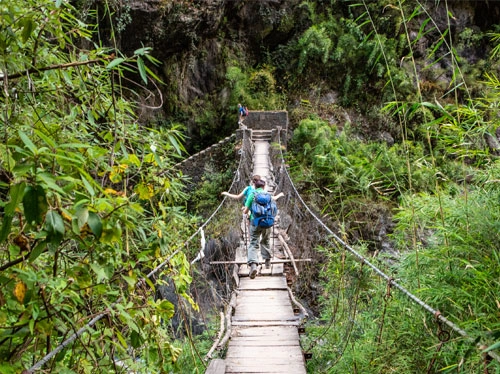
The trail ascends above the Budhi Gandaki River Valley, crossing several suspension bridges, waterfalls & rhododendron forests. You will witness majestic views of Mount Manaslu and many other Himalayan mountains on the way.
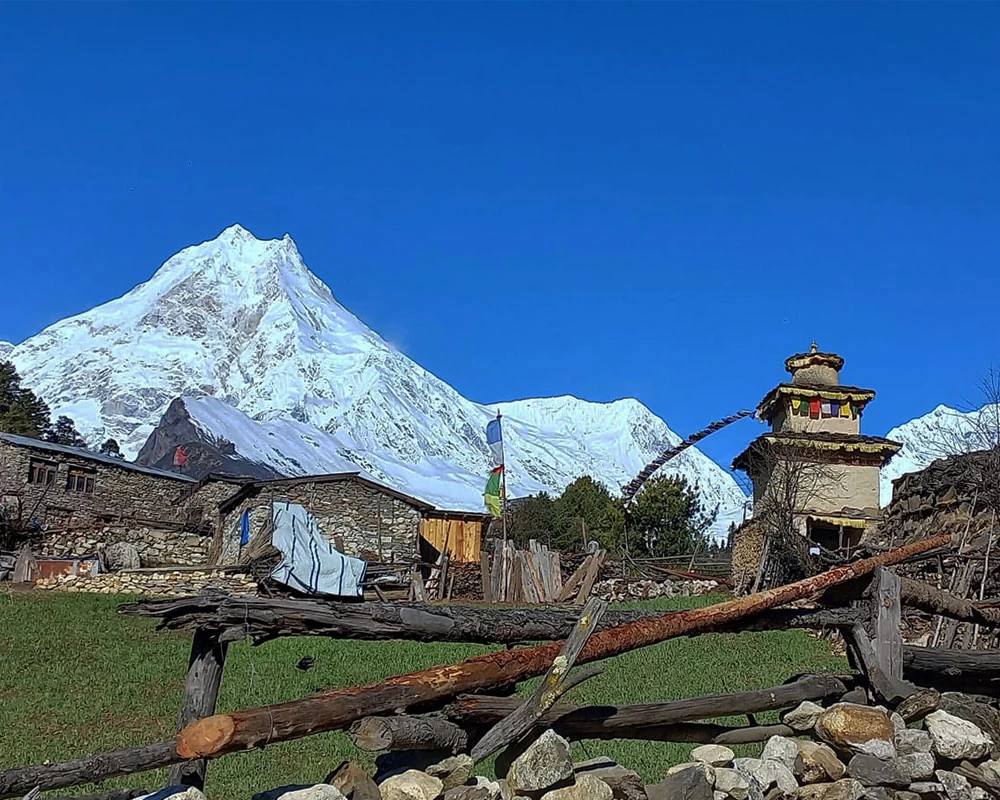
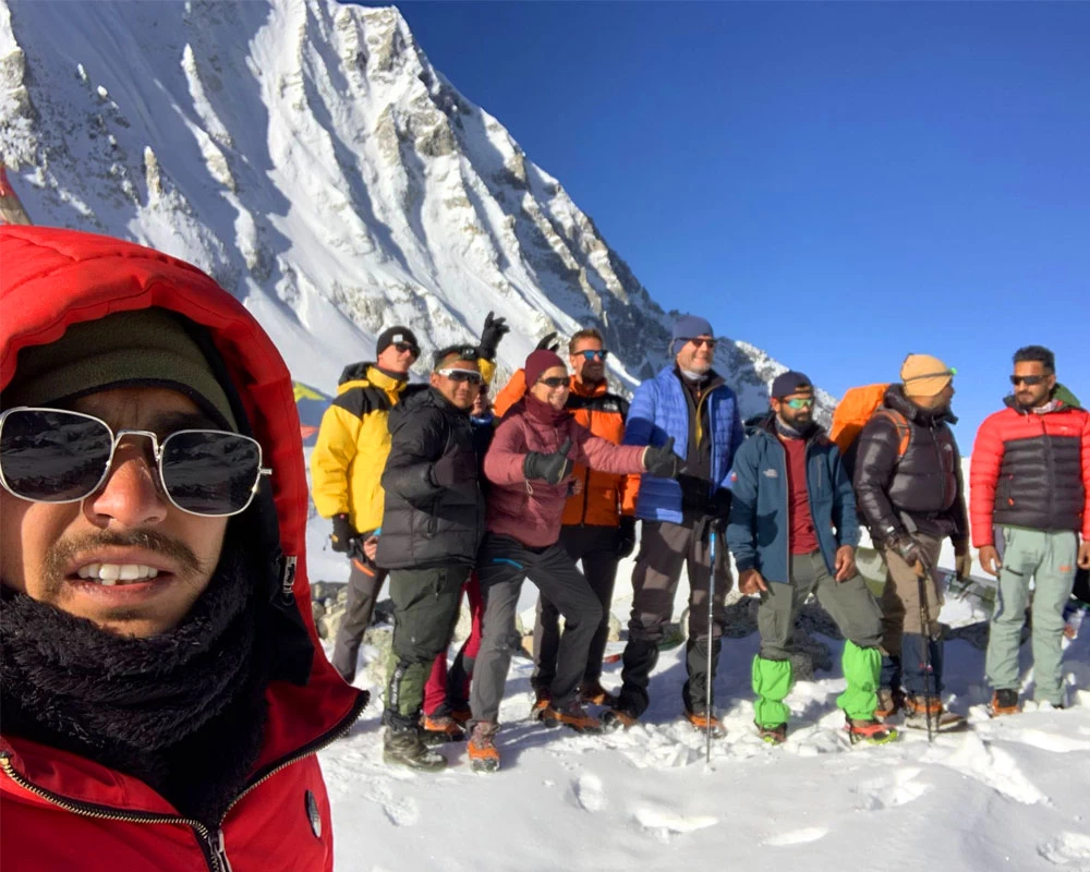
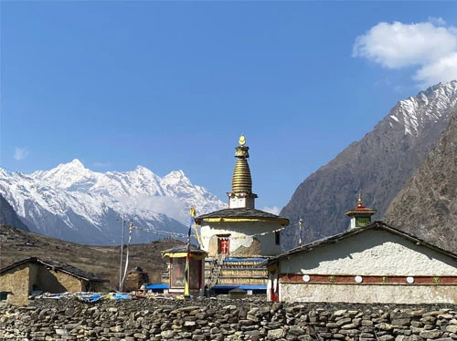
The Nubri community is one of the unique highlights of the Manaslu Circuit trek. You will meet with this community only on this trek. They live between Ghap and Sama Gaon villages. They have their own Nubri language, which is still being studied in foreign universities.
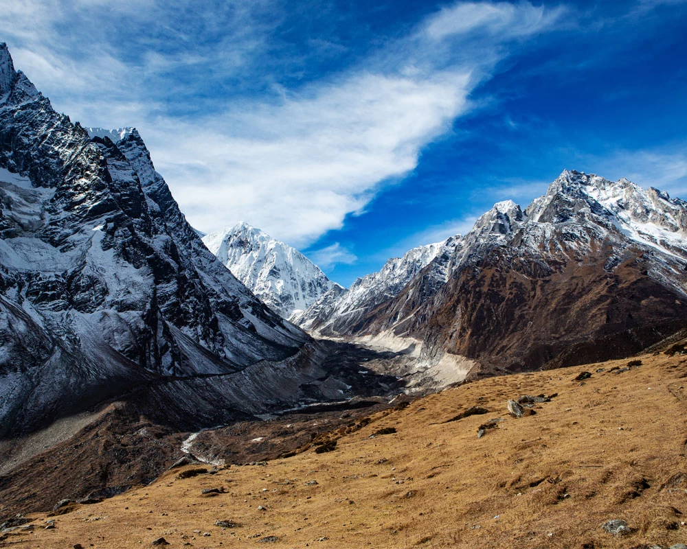
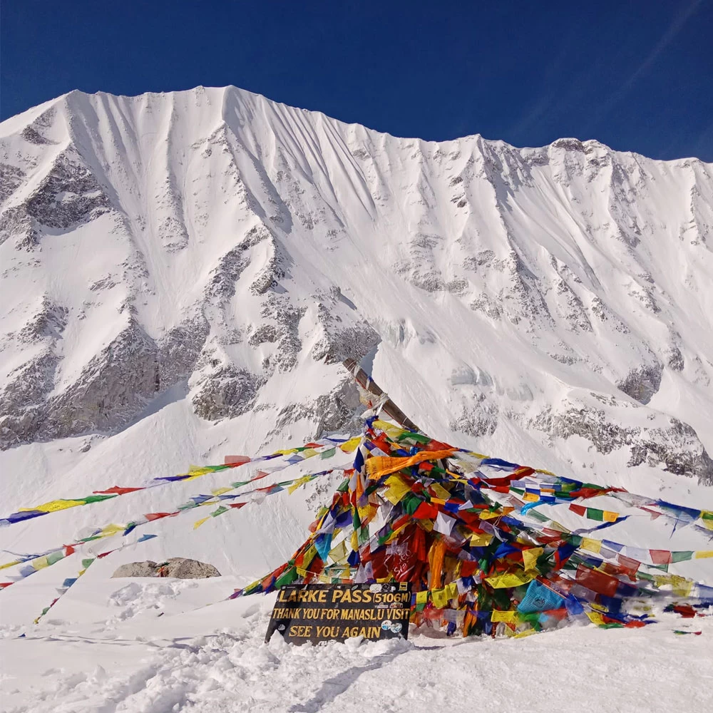
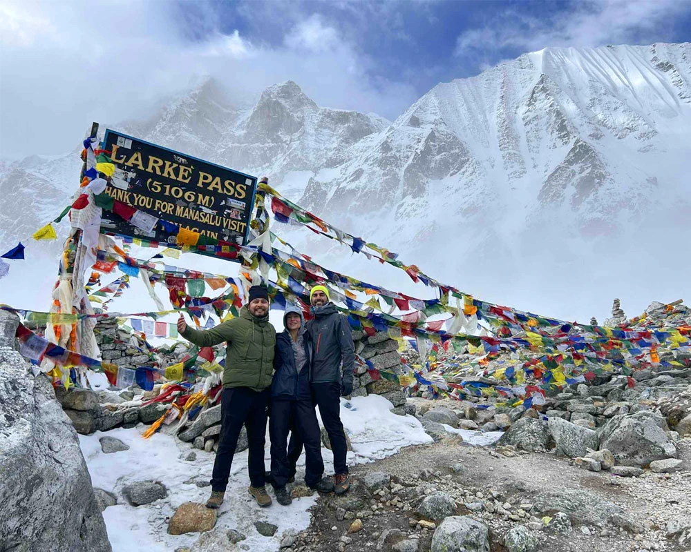
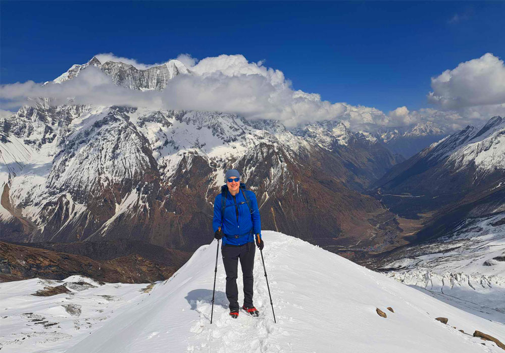
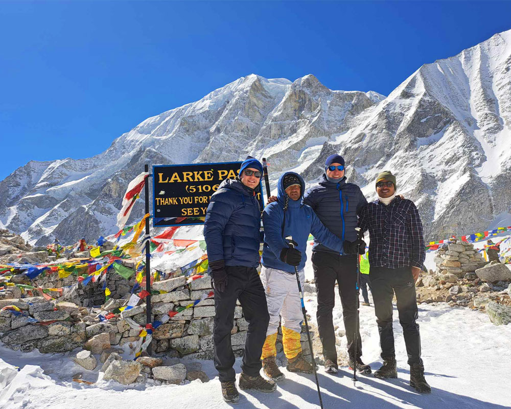
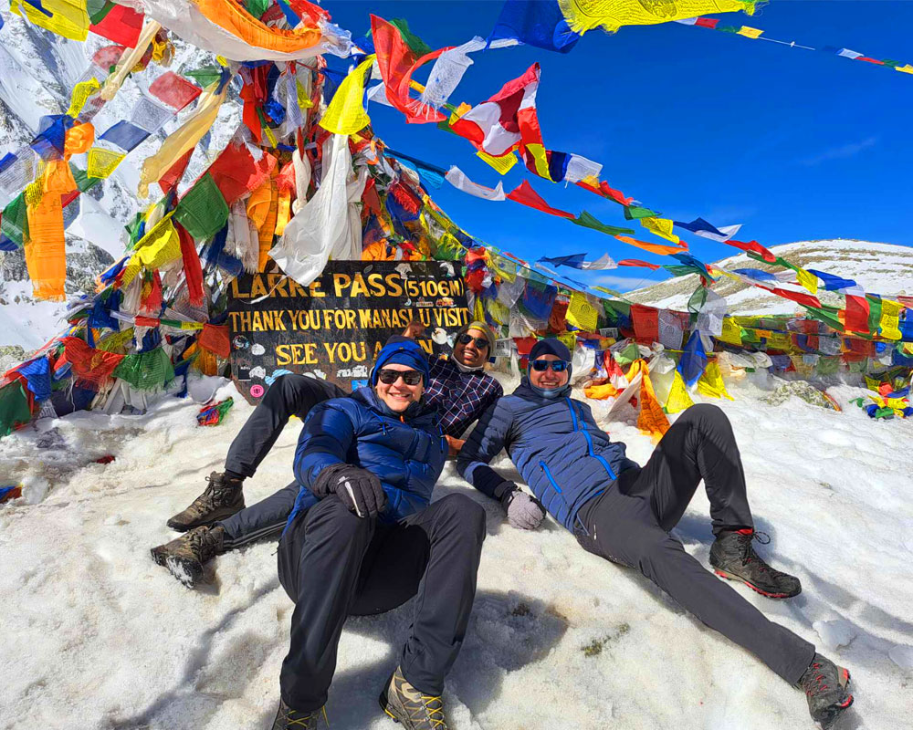
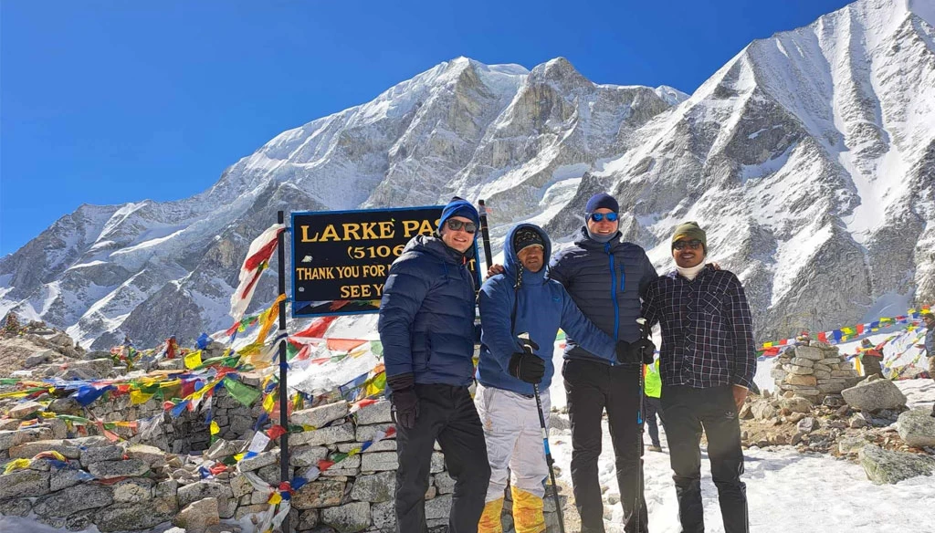
The trail navigates landslide and rockfall areas. Once you ascend above the tree line, you will explore alpine pastures and climb to Larkya La Pass. Larkya La Pass is the toughest part of the Manaslu Circuit trek.
Apart from adventure, a stopover in mountain villages allows you to experience local lifestyle and culture. As not many travelers do the Manaslu Circuit trek, the trail is not commercialized.
So, today it has become one of the very few untouched, raw trekking routes in Nepal where only a few trekkers visit. If you want to dare yourself to push your limits and conquer a true remote wilderness challenge, the Manaslu Circuit trek is best for you.
Some hidden gems of this trek are centuries-old monasteries and stupas, the hidden Tsum Valley, ancient trade routes, and stunning alpine lakes such as Birendra Lake.
We have carefully designed our Manaslu Circuit trek itinerary, maintaining a decent pace and including ample acclimatization days. This itinerary has been built for success. Whether you are trekking for the first time or are an experienced trekker, our Manaslu Circuit trek plan will not let you down.
In fact, it is great for families and young travelers. If you have any further questions or concerns, feel free to reach out to us anytime. We would love to talk to you and possibly curate the perfect Manaslu Circuit trek for you.
Compared to the usual Manaslu Circuit trek itinerary, our itinerary is best to avoid altitude sickness. It's includes a night stay between Namrung and a acclimatization day in Sama Gaon ( Optional hike to Manaslu Base Camp or Birendra Lake)
Restricted off-the-beaten trekking trail in Nepal
Restricted areas, some of the highly protected and preserved parts of the Himalayas in Nepal. These trekking regions are extremely beautiful and untouched.
Trekking infrastructure is also very minimal in restricted areas, unlike the Everest and Annapurna regions, which are quite commercialized.
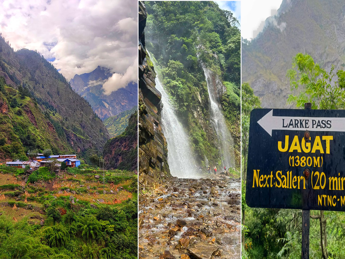
On the Manaslu Circuit trek, you will be exploring one of the restricted areas in Nepal. Above Jagat village, the restricted area begins. It also includes the hidden Tsum Valley.
The restricted areas mostly have off-the-beaten-trails. Likewise, to trek in the Manaslu region or any restricted area, you have to obtain a special restricted area permit and follow some strict rules such as:
Restricted area permits for the Manaslu Circuit trek:
- Manaslu RAP (Manaslu Restricted Area Permit)
- Manaslu Conservation Area Project (MCAP)
- Annapurna Conservation Area Project (ACAP) permits
Restricted area rules for the Manaslu Circuit trek:
- Your Manaslu Circuit trek must be organized by an authorized Nepali trekking agency like us. Only authorized trekking agencies can help you acquire the restricted area permit.
- Both solo trekkers and groups can do the Manaslu Circuit trek. The minimum two trekker requirement has been dropped since April, 2026.
- Trekkers must be accompanied by a licensed Nepali guide.
Manaslu Circuit trek tips
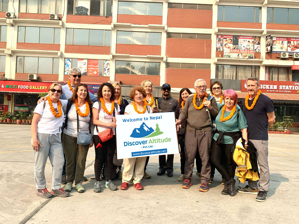
We, Discover Altitude, have been organizing the Manaslu Circuit trek for numerous years. We have led hundreds of trekkers over the years. So, we exactly know how to make the most out of the trek, little things that enhance the journey, and hidden trail secrets.
Below, we have listed some of the tips, and the rest we will share with you when you trek with us:
- If you are on a short vacation, consider starting the Manaslu Circuit trek from Jagat instead of Machha Khola. Recently, new roads have been built up to Jagat village. By starting the trek from Jagat, you skip around 22 km of hiking between Maccha Khola and Jagat and save one full day. However, the drive from Kathmandu to Jagat village gets quite long. So, you have to adjust between these two options.
- Hydration and ascending slowly is key to traveling without suffering from altitude sickness in the Himalayas. Make sure the itinerary you follow suits your fitness, health, and overall condition. Do not push unnecessarily.
- Sleeping bag, water bladder, day pack with nice waist support, compression socks, insect repellent, toilet paper, hand sanitizer, high-quality moisturizer, SPF, and electrolytes are some of the things that you must carry with you during the Manaslu Circuit trek.
- You may come across yaks, mules, and porters carrying heavy loads on the way. Let them pass first and stand on the cliffside while they cross you. Do not disturb them.
- On the Manaslu Circuit trail, you will cross many stupas, chortens, mani walls, and other religious sites. It is okay to look at them closely, but do not touch them without asking your guide. Be respectful to local culture and people.
- There are many side quests and hidden landmarks on the Manaslu Circuit. So, make sure you trek with a guide who can help you explore hidden places while trekking.
- The Manaslu Circuit trek is not as bustling as the EBC or Annapurna trails. So, even in peak seasons, the teahouses and trails can be empty. If you get easily bored without other company, pack some easy-to-carry games or books for time pass. Some trekkers also like to paint.
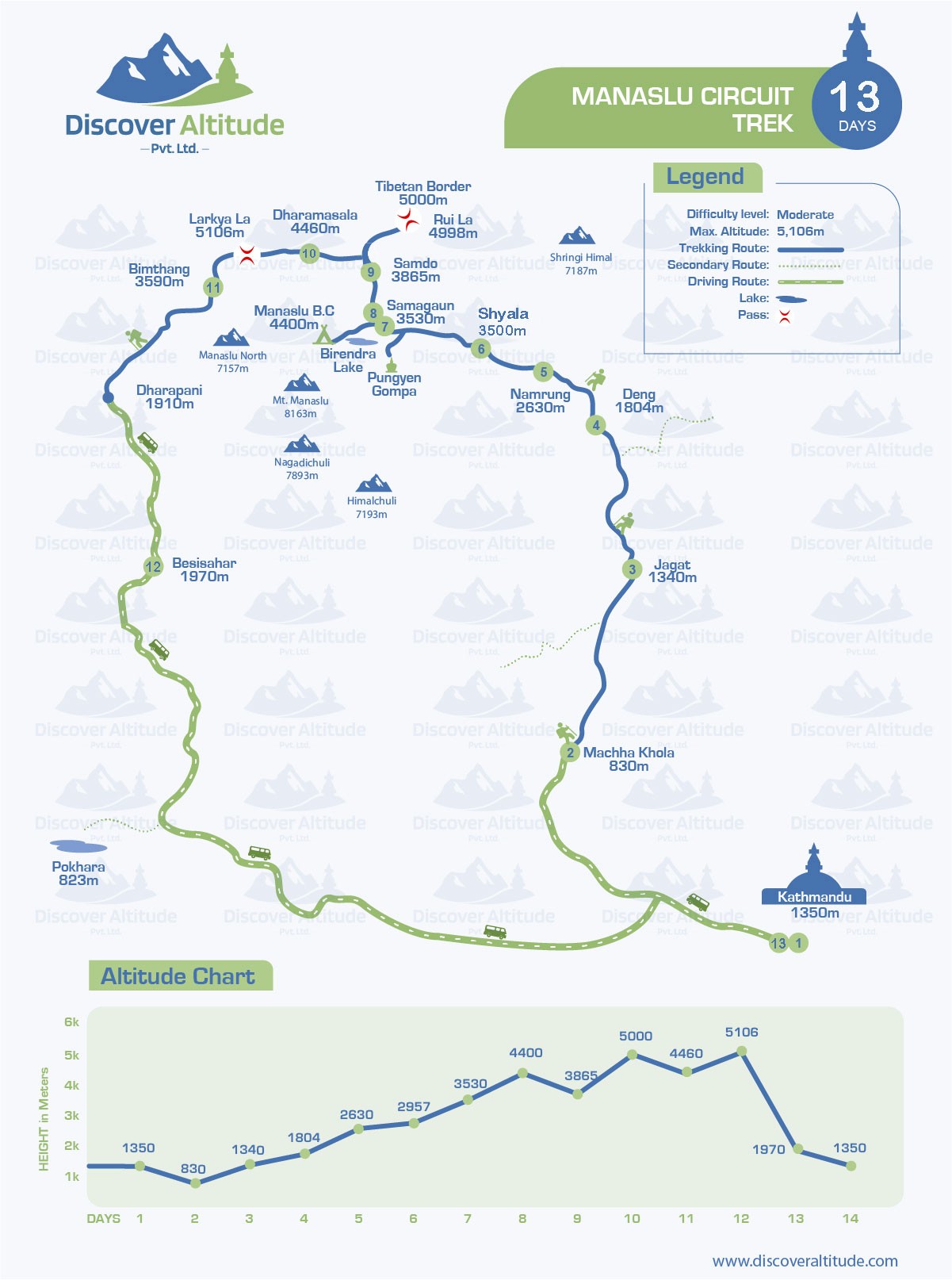
Manaslu Circuit Trek Itinerary Overview : Distance, Duration, and Altitude
The total trekking distance for the Manaslu Circuit Trek is around 177 Km. This distance is to be covered in 12 days but you can extend or decrease the required number of days according to your pace.
Day 1: Kathmandu arrival and transfer to hotel | 1,400 m /4,593 ft
Day 2: Drive from Kathmandu to Machha Khola | 160 km/99 miles | 8-9 hours | 870 m/2,854 ft
Day 3: Trek from Machha Khola to Jagat | 22.2 km/13.7 miles | 6 hours | 1,410 m/4,625 ft
Day 4: Trekking from Jagat to Deng | 19.9 km/12.3 miles | 7 hours | 1,804 m/5,917 ft
Day 5: Trek from Deng to Namrung | 19.5 km/12.1 miles | 6 hours | 2,630 m/8,626 ft
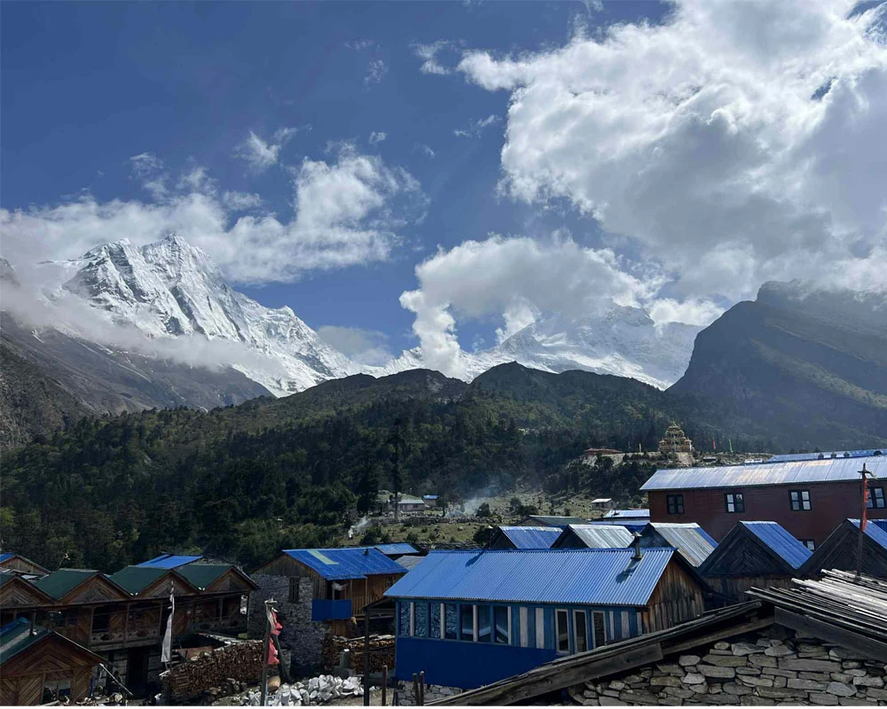
Day 6: Trek from Namrung to Shyala | 11 km/6.8 miles | 4 hours | 3,500 m/11,483 ft
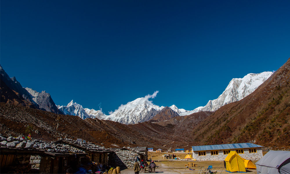
Day 7: Trekking from Shyala to Sama Gaon via Pungyen Gompa | 17 km/10.5 miles |6 hours | 3,520 m/11,548 ft
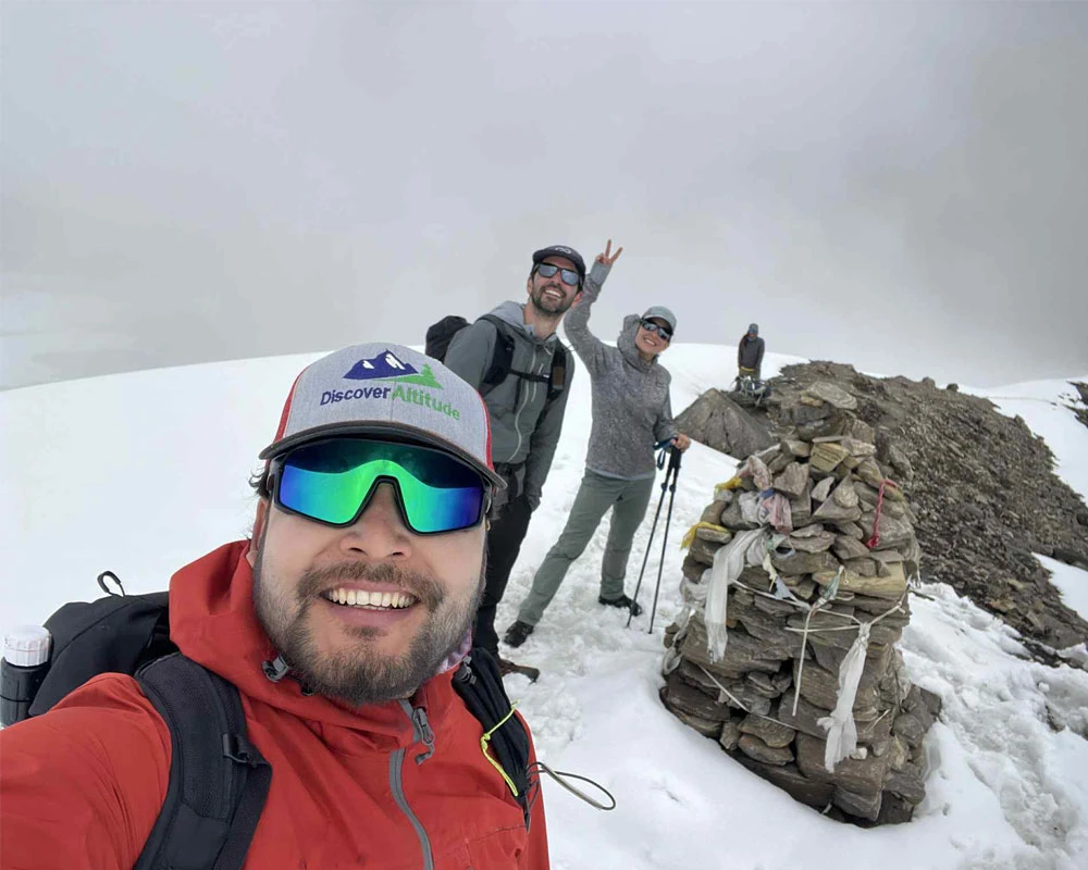
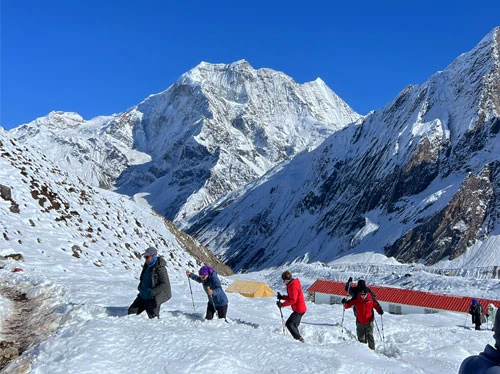
Day 8: Acclimatization day | Hike to Manaslu Base Camp & Birendra Lake | 3,530 m/11,581 ft
Day 9: Trek from Sama Gaon to Samdo | 8.2 km/5 miles | 3-4 hours | 3,875 m/12,713 ft
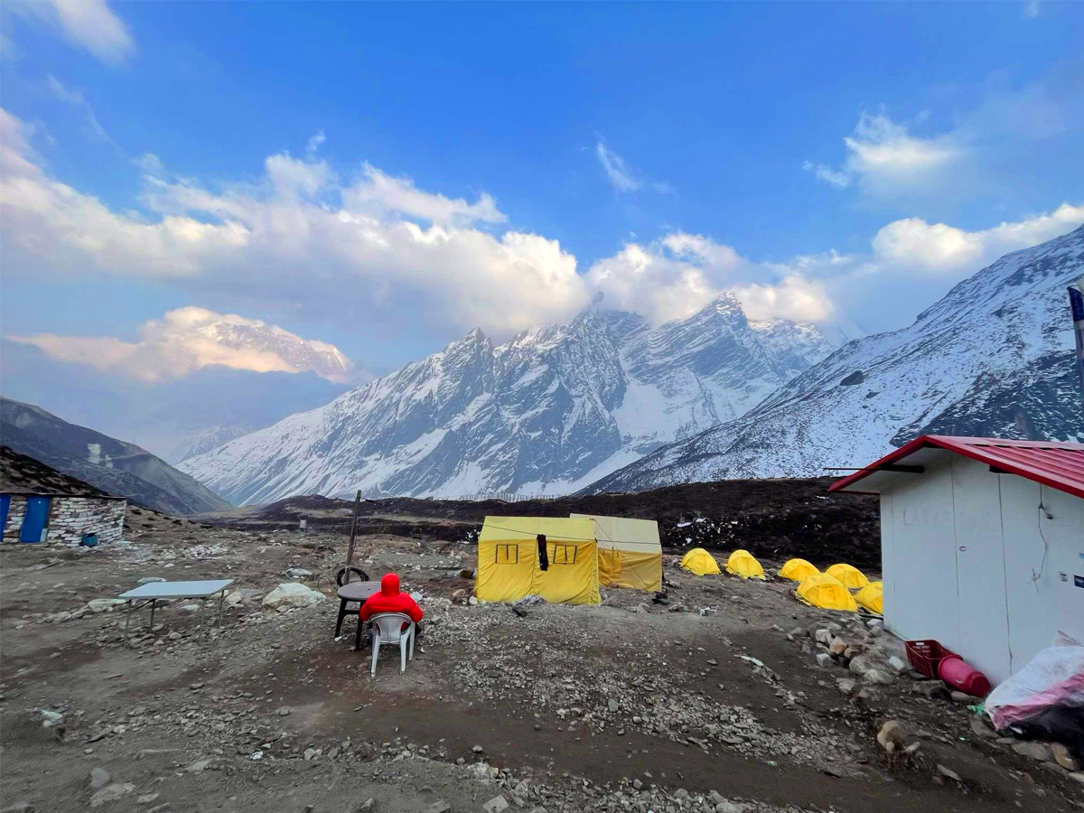
Day 10: Trek from Samdo to Larke Phedi (Dharamsala) | 11.7 km/7.2 miles | 4-5 hours | 4,480 m/14,698 ft
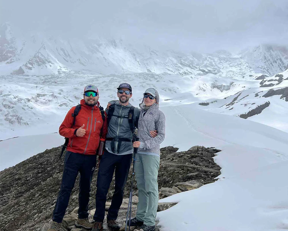
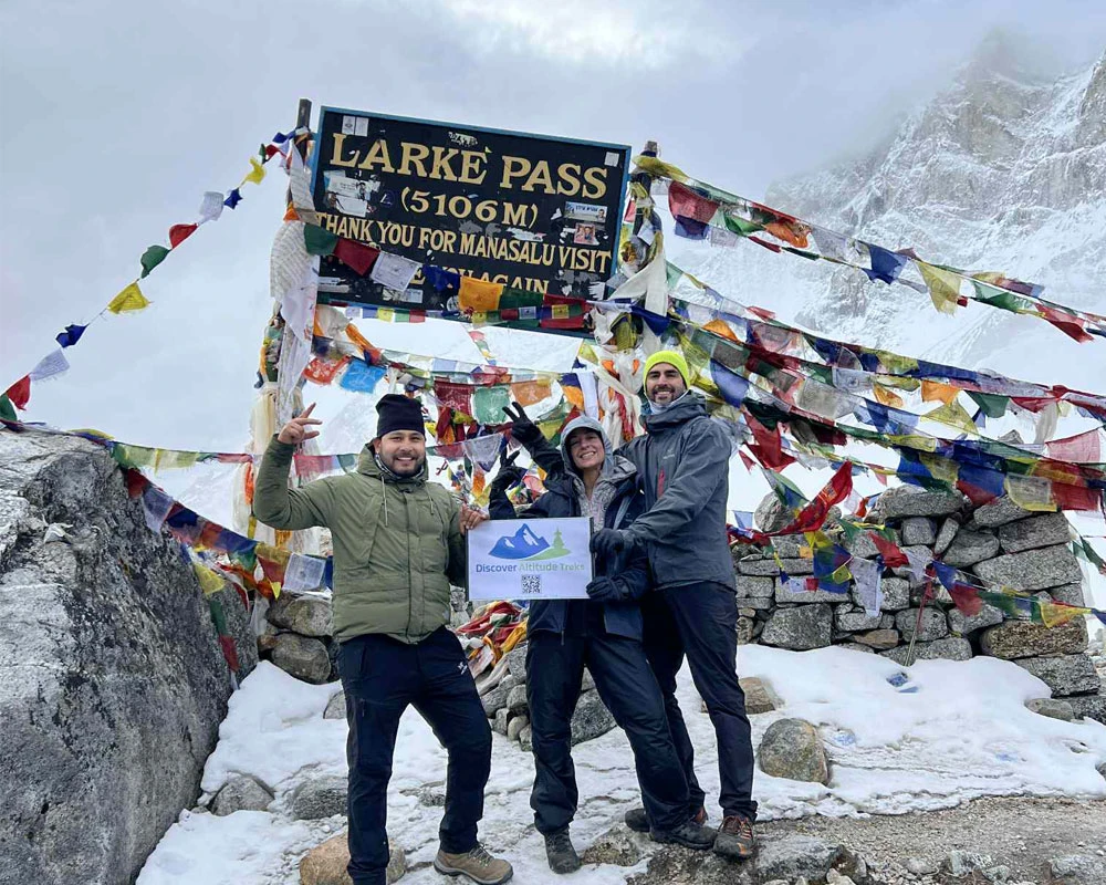
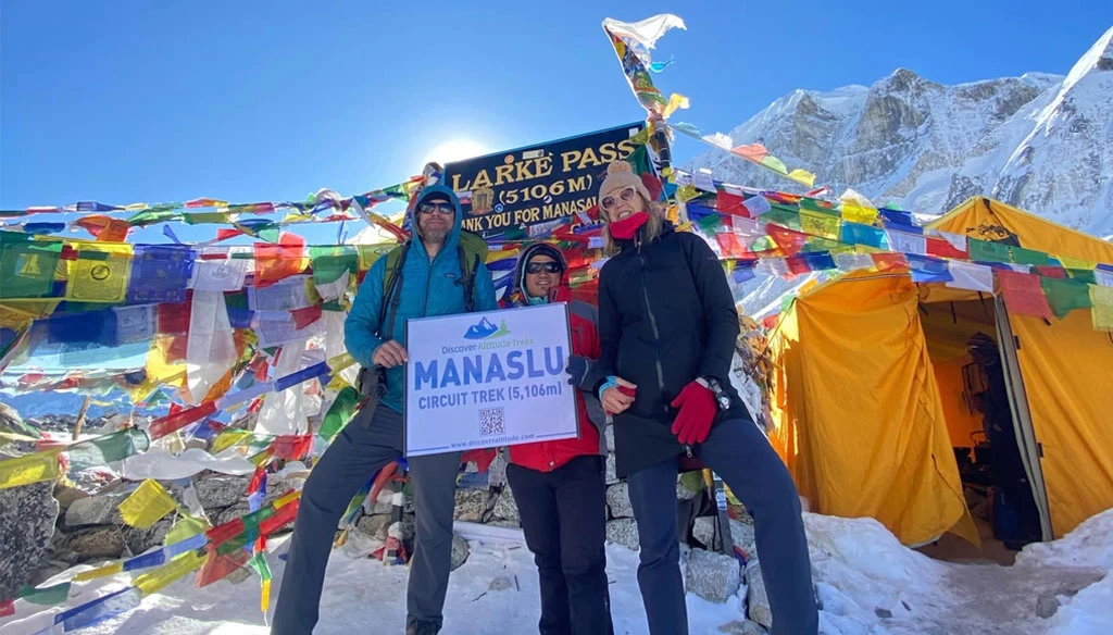
Day 11: Trek from Larke Phedi to Bimthang via crossing Larkya La Pass (5106m) | 24.7 km/15.3 miles | 8-9 hours | 3,720 m/12,205 ft
Day 12: Trek fropm Bimthang to Dharapani and drive to Besisahar | 51 km/31.6 miles | 6-7 hours | 760 m/2,493 ft
Day 13: Luxury bus drive from Besisahar to Kathmandu | 175 km/109 miles | 8 hours | 1,324 m/4,344 ft
Why Choose the Manaslu Circuit Trek?
- On the Manaslu Circuit trek, you will enjoy a peaceful walk. This trek is not as busy as the famous treks in Nepal. The trail remains less crowded even in the spring and autumn seasons.
- The adventure and thrill the Manaslu Circuit trek offers are unmatched. The trail goes through subtropical forests, landslide-prone areas, alpine meadows, and glacier moraines, crossing several suspension bridges and streams on the way.
- The diverse landscapes are another major reason that makes the Manaslu Circuit one of the best treks in the Himalayas. You cannot even fathom the variety of scenery you will get to enjoy on this trek. And the mountain views are equally incredible.
- The rich Tibetan Buddhism heritage will sprinkle mystique and spiritual essence on your journey. The Manaslu Circuit route is close to Tibet, so you will see a perfect amalgamation of Nepali and Tibetan heritages. The stories, myths, and beliefs of the locals will add more character to your Manaslu Circuit trek.
- While trekking at different altitudes, you will come across different climatic zones. It means you will discover a wide range of vegetation. Likewise, the Manaslu region is also home to many species of wildlife, including the rare snow leopard. Who knows, you may get to spot one?
- Finally, we cannot emphasize enough how the Manaslu Circuit trek will change your life and perspective. It will give you a break from the world. You will connect with nature, push your limits, and also get a break from toxic food.
Best Side Trips on the Manaslu Circuit Trek
Manaslu Circuit Trail is a diverse area that has may alternatively spot trekkers can explore during the complete Manaslu Circuit Trek. Here, travelers during the Manaslu Circuit Trek can visit some of the most popular highlighted places that doesn’t falls in the trail but can be diverted through the alternative trail to explore those with or without additional days.
This can be done either extending couple of hours in your day hike or by reserving a day to make it a day excursion tour. One can make an exceptional journey by just skipping the main trail and then rejoin the trail with the side trip. Something which falls within the main trail are easy to explore but there are some of the popular highlighted places that either need to hike with couple of additional hours or some with a reserve day.
Further, if trekkers want to add an additional trek with the Manaslu Circuit Trek to make it a combo, that too will be possible. There are multiple trekking trails that can be adjoin with the Manaslu Circuit Trek, in details we have mentioned at the last part of this section.
Now, let’s talk about some of the popular and highlighted side trip which can be done during the Manaslu Circuit Trek.
Pungyen Monastery/Gompa
Pungyen Gompa also known as Pungyen Monastery is one of the most fascinating spots in the Manaslu Region and trekkers can explore this site when one diverts the trail from SHYALA (3,500 meters ) to Pungyen Gomapa (4,000 meters).
This side trip to Pungyen Gompa during the Manaslu Circuit Trek benefits trekkers in multiple ways. It works as an acclimatization before descending to Samagaun (3,530 meters) to spend a night. The best part of visiting Pungyen Gompa is the majestic trail and jaw-dropping vegetations. Trekkers will be able to explore flora and fauna and enjoy the jaw dropping views of the Mount Manaslu, glacier and the surrounding Himalayan ranges.
Finally, on reaching the Pungyen Gompa, you will feel the presence of spiritual vibe of the monastery which was build more than 400 years ago by the local community to retreat and practice meditation, and still the presence of monks and their daily ritual and chanting goes on every day.
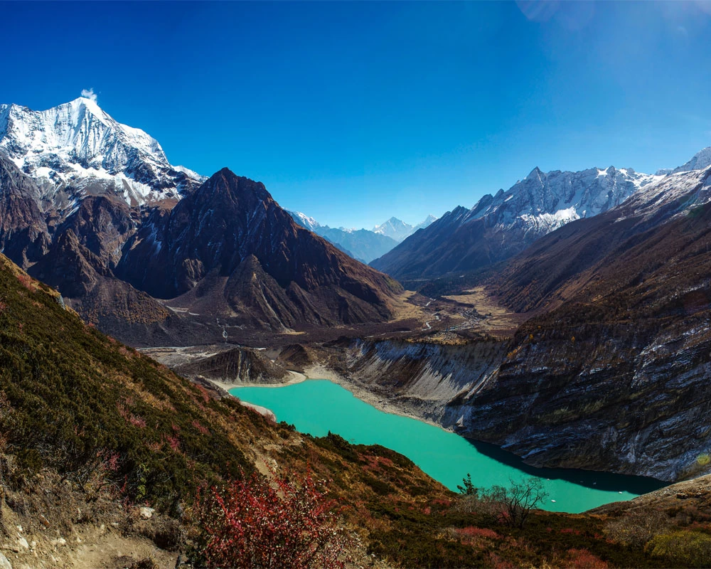
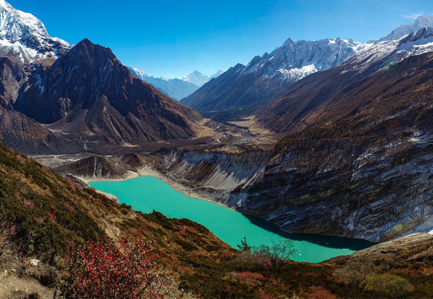
Birendra Lake
Birendra Lake is another highlight of the Manaslu Circuit Trek that takes travelers to one of the popular Manaslu Glacier, known as Birendra Lake, named after the former King of Nepal, King Birendra Bir Bikram Shah.
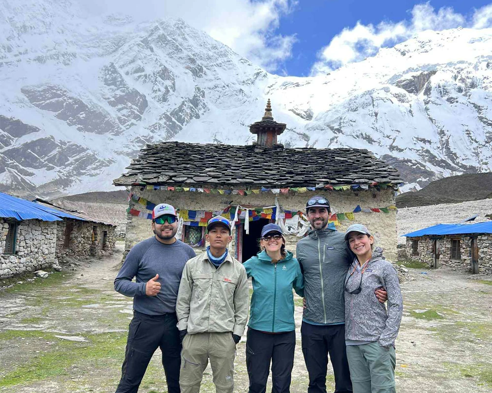
Birendra Lake is a fresh water lake formed by the melting-snow of the Mount Manaslu at an altitude of 3,700 Meters, with majestic green and blue in color and scenic view around. However, during the winter the lake gets frozen. Lies at an altitude of 3700 meters, Birendra Lake and Manaslu Base Camp (4 800 meters) together can be a perfect day hike for trekkers from Samagaun (3,520 meters) and this day hike will work as an acclimatization day for trekkers who wants to continue their hike towards the Larkey La Pass (5,106 meters).
Manaslu Base Camp
Manaslu Base Camp is one of the wonders of the entire Manaslu Circuit Trek and falls as a side trip during the Manaslu Circuit Trek. Trekkers on the acclimatization day, explore Birendra Lake and Manaslu Base Camp together because the side trip trail follows the same route.
Trekkers planning for the Manaslu Base Camp will have to keep a reserve day/acclimatization day in Samagaun (3, 520 meters), which normally all the trekkers do to acclimatize themselves before going higher to continue the Manaslu Circuit Trail.
Manaslu Base Camp is a scenic point during the Manaslu Circuit Trek which lies at an altitude of 4,800 Meters. During the climbing season, trekkers will have an opportunity to meet the expeditions group and the organized tent can be seen everywhere.
Tibet Border
Tibet border excursion tour during the Manaslu Circuit Trek will be one of the best and a life-time memory for trekkers. As the Manaslu Region itself share its border with the Tibet and there are point where trekkers can enjoy visiting the border as a side trip.
Trekkers from Samdo (3,875 meters) can hike all the way to the Tibet border to explore. This will be a majestic hike through the Himalayas and the pass to reach the border, a popular and famous trade route of the entire Manaslu region.
The hike from SAMDO to Tibet will be around 7-8 hours of round trip, however, carrying water and some snacks will be an advantage because this trade route lacks any tea house or villages.
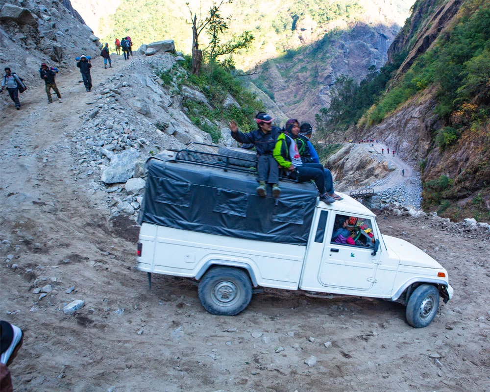
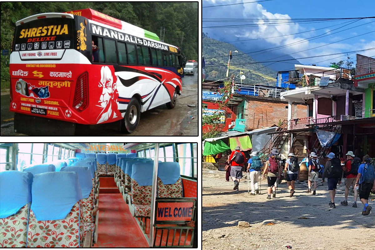
Transportation Information for Manaslu Trek
Manaslu Circuit Trail falls under the conservation area (MCAP), hence constructing of road is strictly forbidden, however, till the starting point one can have an option of drive available and the after the descend via the Larkey La Pass, one will have an option of drive to Kathmandu. This can be done in two different ways, private Jeep and sharing Jeep/Bus.
Travelers must note that after passing the main highway, the road to the starting point Maccha Khola/Jagat will be an off-road drive and as the trek ends in Dharapani the road to Beshi Sahar will be off-road drive.
1. Local Bus / Local Jeep
The first day of the drive to the starting Point (Maccha Khola) will be a bus drive from Kathmandu and if trekkers want to continue till Jagat, then you will need to take a sharing jeep from Maccha Khola without any alternative option. Here, kindly notes the bus from Kathmandu only commerce till Maccha Khola early in the morning.
Further, as the trek ends in Dharpani, you will only have an option of sharing local jeep till Beshi Sahar and then one can take a bus or HiAce drive to Kathmandu.
2. Private Jeep
The best part to start the Manaslu Circuit Trek is to go with a private transport to the starting point from Kathmandu and ends with a private transport from Dharapani to Kathmandu. Private transport benefits travelers in multiple ways, it gives flexibility to stop in any of the places of your interest.
Further, drive in Private transport will be faster and comfortable then the local sharing transport and you can start the drive from your hotel at your flexible time.
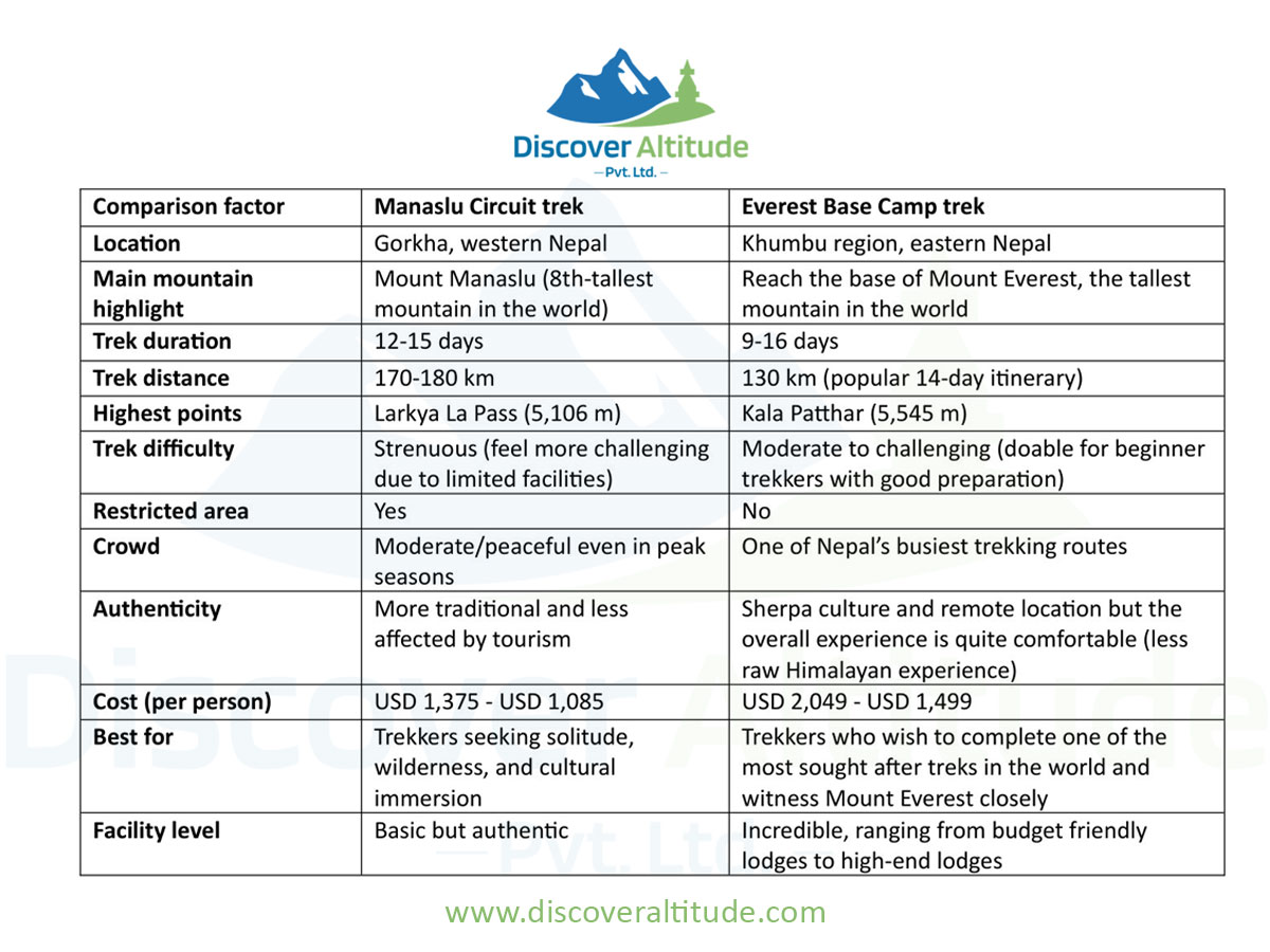
Manaslu Circuit Vs Annapurna Circuit
The Manaslu Circuit and the Annapurna Circuit are two amazing adventure trekking routes. Both these treks are famous for their remote wilderness, authentic Himalayan experience, and rich cultural encounters.
You will cross 5,000 meters+ mountain passes on both treks and enjoy diverse landscapes. The major difference between the Manaslu Circuit and the Annapurna Circuit comes down to the trekking region, facilities along the trail, and elevation gain.
We have talked more in detail about both these treks in our Manaslu Circuit vs Annapurna Circuit blog. You can read this blog for more information and detailed comparison.
Manaslu Circuit Vs Everest Base Camp
We are again talking about the two best treks in Nepal here. Whether you choose to do the Manaslu Circuit trek or the Everest Base Camp trek, you will have an incredible experience.
The facilities for trekkers are better on the EBC trek route than on the Manaslu Circuit. However, the Manaslu Circuit presents a much more remote, uncorrupted, and rugged offbeat experience.
In addition, the Everest Base Camp (EBC) trek is best for beginner trekkers. But the Manaslu Circuit best suits trekkers with previous high-altitude experience.
We have shared the major differences between the Manaslu Circuit trek and the Everest Base Camp trek below:
Manaslu Circuit Trek for Solo Female Travelers
Despite Manaslu Circuit Trail being a remote and restricted region, Solo travelers can trek Manaslu Circuit Trek in an easy and comfortable way. The ban on at lest 2 travelers to obtain permits has already been lifted by the government, however, a registered guide and an organized trek by the local agency is must for the Manaslu Trek.
Any of the solo travelers can trek Manaslu Circuit Trail without any difficulty. The trail to Manaslu Circuit is safe for solo female travelers as well. For a solo female traveler, trekking the Manaslu Circuit Trek will be a majestic journey, as you will be accompanied by a professional trekking guide.
Manaslu Circuit Trek for Families
Manaslu Circuit Trek for families will be a perfect destination when you are in a group of not less than 2 travelers. The best part for families during the Manaslu Circuit Trek will be to go in a private way, without any group joining with unknown travelers.
Trekking Manaslu Circuit with a family in a comfortable way at comfortable pace, explore the side trip will add benefits with scenic beauty and also gives you time to acclimatize with an altitude gain.
Further, you can continue the entire circuit of the Manaslu trail or descend from some point will also be an option when you are with kids or children.
Manaslu Circuit Trek for Seniors & Kids
If you are a first-time trekkers or Senior citizen and planning for the Manaslu Circuit Trek, then the best option is to follow the customized itinerary or at least be flexible with the number of days and try to keep a reserve day. This will give you flexibility to stop at any additional place when you need to acclimatize.
Trekking Manaslu Circuit Trek as a senior citizen needs to be a bit careful with your itinerary, so it is better to consult with Discover Altitude Team and take advice of experts. They will make sure your itinerary goes in a perfect way maintain the distance and also the altitude gain.
Road Access and Short Itinerary Options for Limited-Time Travelers
Manaslu falls under the restricted areas; however, the lower part of Manaslu region has access with driving road. Trekkers who are tight with their schedule for a long trek, they can easily drive from Kathmandu to the point where the road ends and this can be Jagat or Philim depending upon the condition of the road on that particular day.
Further, after the trek, trekkers can drive all the way to Kathmandu from Dharapani to end their trek in Kathmandu on the same day. This option will make your entire trek a short Manaslu Circuit Trek, saving 3 days.
However, trekkers will further have an option of customizing the itinerary in a proper way maintain the distance covered and also the altitude gain. Moreover, trekkers will again have an option to use helicopter after the Larkey La Pass either in the Phedi or Bhimthang and this will shorten around 2/3 more days to the trek or one can skip couple of overnight camp at the low altitude.
Following the best possible way there are still option for trekkers to make the Manaslu Circuit Trek an easy and time-consuming program that can be completed within 6/7 days in total.
Manaslu Circuit Trek with Helicopter Return
(Hike to Base Camp, next day Heli Return from Samagaon) OR, trek to Phedi/Bhimthang after the Larkey La Pass and then take a Heli ride back to Kathmandu
Manaslu Trek with Helicopter Return will be one of the finest options for trekkers who are restricted with their long duration of trek or those who wants to skip the high altitude and also for senior citizen and children.
This will be a luxury trek to the low altitude of the Manaslu Region and one can enjoy diverse vegetation, majestic landscape, magnificent Himalayan vista, rural villages, monasteries, Birendra lake and the majestic Manaslu Base Camp.
The hike to Manaslu with Helicopter option will take trekkers to Samagaon for two nights. This will be a reserve second day to explore Manaslu Base Camp and Birendra lake and on the third day, you will take a helicopter ride from Sanagaon to Kathmandu.
Further, if one wants to complete the circuit via Larkey La Pass, then you can take a Helicopter ride from Phedi or Bhimthang after the Pass and fly directly to Kathmandu and this will save 3 additional days of the trek.
Manaslu Circuit Trek without Larkey La Pass (5106M)
Manaslu Trek without Larkey La Pass will be a short hike to the lower part of the Manaslu Region. The trail remains the same and is only suitable for those trekkers who wants to skip the high altitude or the Larkey La Pass (5,106 meters).
Here, trekkers will have an option to hike as per their interest and this can be till Samagaon or Sambo, exploring the entire side trip that falls during the Manaslu Circuit Trek. Spending a reserve day in Samagaon will take you to the Birendra Lake and Manaslu Base Camp and further, having a reserve day in Samdo can lead you towards Tibet Border.
Thus, trekkers who wants to skip the high altitude but still wants to explore the Manaslu region and the majestic Himalayas, this will be a majestic low-altitude trek.
Charging, a hot shower, internet, and a toilet during the Manaslu Circuit Trek
Note that all the services mentioned below cost extra money, and our Manaslu Circuit trek Package does not cover these expenses. So, we recommend that trekkers budget daily personal expenses for the trek.
- Charging: The charging cost is usually USD 1 to USD 3 per device. There are separate charging stations in the tea houses where trekkers charge their devices. Spare batteries, solar chargers, and power banks will be convenient.
- Hot shower: Water is always cold in the mountains. The tea houses offer warm water free of cost to wash your face, but for the shower, you need lots of water, which costs extra money. The hot shower may cost USD 5 to USD 7. Taking a hot shower at a higher altitude is not easy because of the cold climate. It is best if you pack wet wipes to keep yourself refreshed when you can't take a shower.
- Internet: WiFi is available at lower elevations. You may get WiFi in Namrung and Sama Gaon, but the network will not be stable. Likewise, there is no mobile network in most parts of the Manaslu Circuit trek route. Therefore, we recommend trekkers take this trek as a break from the digital world. WiFi also costs around USD 3 to USD 5.
- Toilet: Western-style toilets are not available on the trail. You also have to use squat toilets. Prepare yourself mentally for that. Pack toilet paper, soap, hand sanitizer, etc.
Book Now | Customize | Check Availablity: Group Joining Date and Price: Click Here
Connect WhatsApp to speak trip expert +977 9851149890
Is the Manaslu Circuit Trek suitable for you?
The Manaslu Circuit trek is not as easy as the standard treks in Nepal. It is an advanced trek, ideal for trekkers who have previous trekking expertise and good fitness.
With that being said, beginner trekkers may go for the Manaslu Circuit trek if they are confident in their fitness and can push themselves. So, fitness is the first thing anyone planning to do the Manaslu Circuit trek should consider.
The next factor to consider is the limited infrastructure. Unlike the Everest and Annapurna regions, the services and infrastructure are very limited on the Manaslu Circuit.
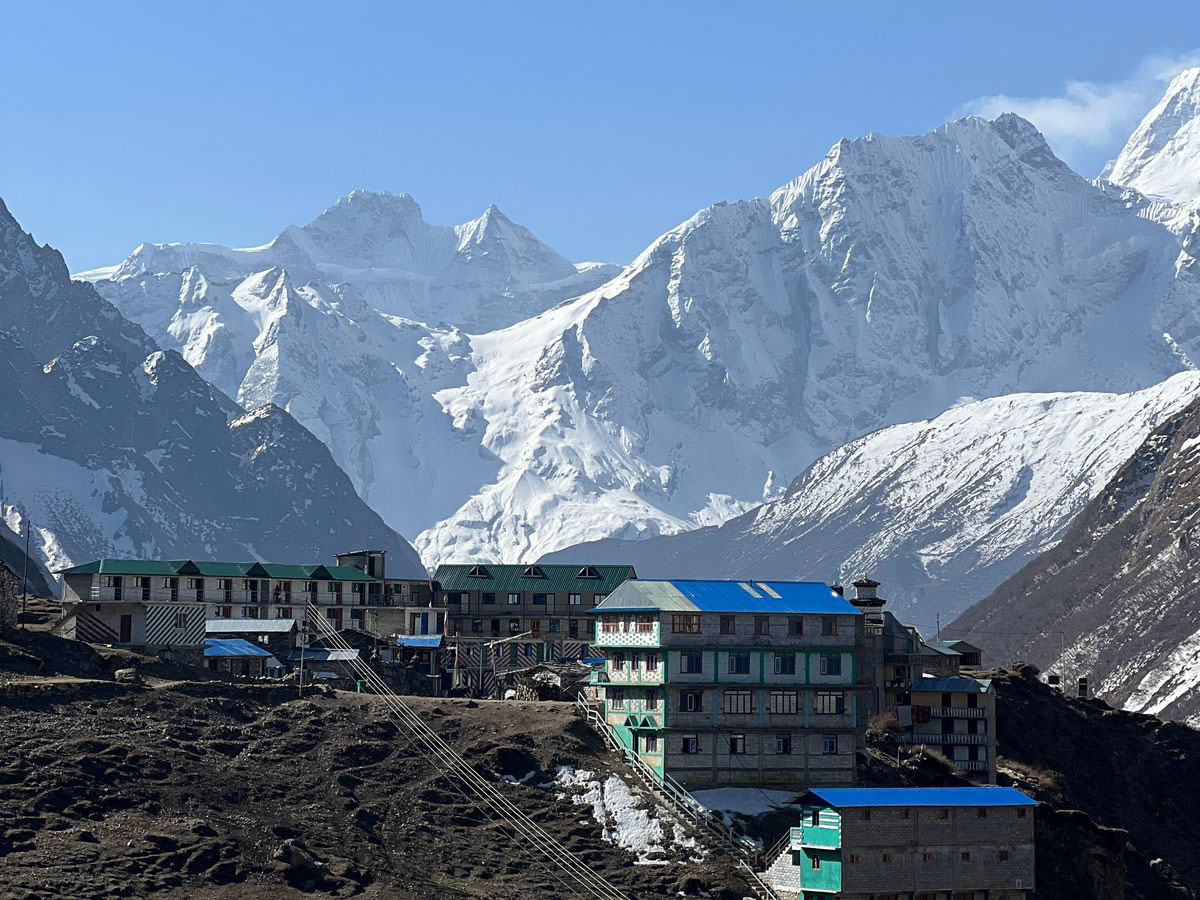
You will find comfortable teahouses to spend nights up to Namrung, but after this point, the services and options are very limited. So, ask yourself a question: are you mentally ready to adjust to a simple mountain lifestyle?
How to Prepare for the Manaslu Trek?
First and foremost, you have to take care of your physical fitness for the Manaslu Circuit trek. As the Manaslu Circuit trek involves daily 6 hours of walking minimum, it is important that you are ready for that.
Weight training: Walking long hours on rugged terrain with a backpack demands strength. By weight training, you will strengthen your core, back, and leg muscles, which will help you a lot during the trek.
Cardiovascular exercises: Regular swimming, cycling, running, jogging, etc, will help you improve your stamina and endurance. It will also mentally push your mind.
Mental training: With the rise in elevation, walking becomes tougher due to low oxygen levels and high air pressure. You will be pushing yourself mentally a lot. We recommend practicing long breathing and meditation, etc. These two activities will keep you grounded during nervous breakdowns and over-excitement.
Learn about the region: Manaslu is not well-studied like Everest and Annapurna. Therefore, the infrastructure is very basic, and you have to adjust a lot.
Manaslu Circuit Trek Solo Rules 2026 - Is Solo Trekking Allowed?
Yes, solo trekking is now allowed in the Manaslu Circuit trek. The Manaslu region is still a restricted area so you must go through registered local trekking agency and mendatory to trek with guide.
Therefore, you can do in a group or solo no problem. Now, you can bring your own trekking partner, or if you are a solo traveler, you can join one of our groups for the Manaslu Circuit Trek.
Our groups are small, up to 8 trekkers. If you have any more questions, kindly contact us anytime.
Manaslu Circuit Trek Updated Cost 2026 and 2027
First of all, we have the most reasonable (without compromise in service) pricing for the Manaslu Circuit trek. Our Manaslu Circuit trek cost depends on the group size and trekking time.
For a group of more than 10 trekkers, kindly contact us for a special group discount.
| Number of Trekkers | Starting Price | Inquiry |
| 2 to 6 | $1085 | |
| 7 to 10 | $1050 | |
| 11 to 18 | $985 |
What is it like doing the Manaslu Circuit trek with Discover Altitude?
The Discover Altitude team presents a long legacy in the Himalayas. We have been operating treks, tours, and peak climbing trips in Nepal for many years.
Our team has multiple generations, boasting expertise, youth, and reliability. We are updated with new trekking methods, supplies, and practices. You will get the best Manaslu Circuit trek price and service with us.
As one of the local Nepali trekking companies, we strive to show our beautiful country to the world. We ensure our trips are safe and our guests enjoy hassle-free holidays.
For the Manaslu Circuit trek, we take care of permits, accommodation and meals, transportation, guide, porter, airport transfers, etc. You will have the best Manaslu Circuit trekking experience with us.
Bookings are open for Manaslu Circuit Trek 2026/2027 departures!
- Local expertise: For the Manaslu Circuit Trek, we work with guides and porters who are born and raised in the Manaslu region. Our guides are trained to assist trekkers and have many years of expertise.
- Well-managed logistics: By trekking with us, you can forget about permits, accommodation, transportation, and all other details. Our team will handle them for you and ensure there is no hassle for you.
- Guaranteed departure: We do not cancel any trip. You do not have to worry about the trip getting canceled with us.
- No hidden charges: We are transparent with our Manalsu Circuit trek pricing and what it includes and what it does not. You will get the best Manalsu Circuit trek cost with us.
- Exceptional client support: We have a dedicated team that will assist you from the start to the end of the Manaslu Circuit trek in Nepal. You will never be left alone or stranded by traveling with us.
- Airport transfers: We provide complimentary airport transfers as per our itinerary to our guests. It makes your travel experience in Nepal seamless.
- Duffel bags: A high-quality duffel bag can become a big investment, so we provide free Discover Altitude duffel bags to our guests. They can use it during the trek and return after the trip ends.
- Safe booking system: We have streamlined trek booking in Nepal with our safe system. You can now book the Manaslu Circuit trek or any other trip to Nepal easily and safely with us. Our secure system protects your personal card details.