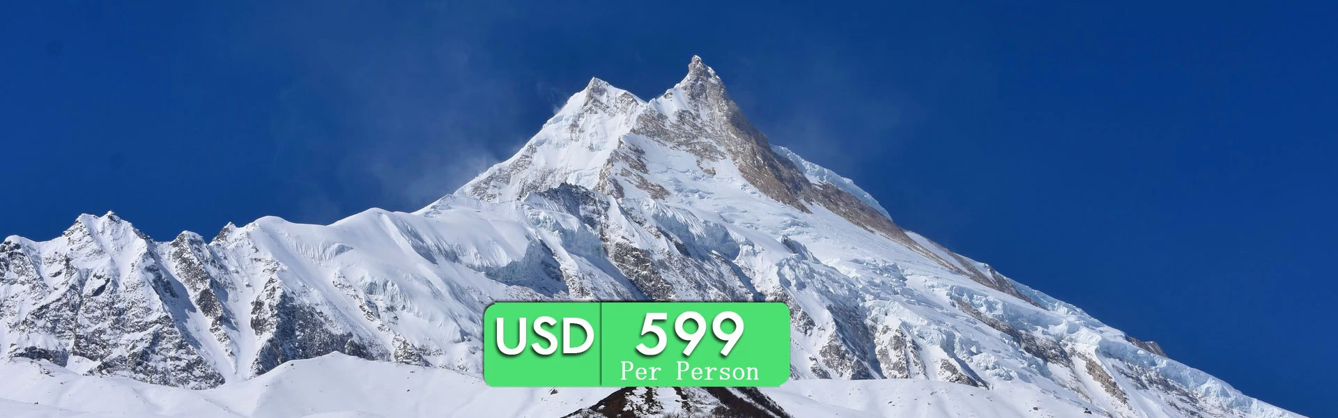
a pristine destination with the magnificent view to the restricted area of Nepal...
Updated on Jul 5, 2026
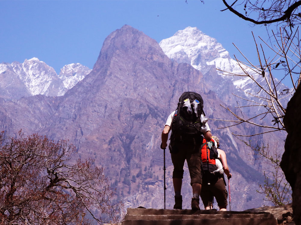
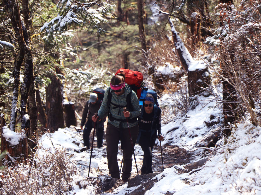
Short Manaslu Trek is a perfect trail for any trekkers who prefer less crowd while hiking and are bound by time frame. This is an isolated trek due to its wilderness, remoteness, and restricted region, trekkers require a special permit to accomplish Manaslu Circuit Trek, Tsum Valley Trek, or any trek associated with the Manaslu region.
Outline Itinerary of Short Manaslu Circuit Trek: The trip starts from Kathmandu and ends in Pokhara or Kathmandu as you wish
Day 01: Drive to Maccha Khola 930m (3,051ft) on a local bus or private jeep - 7-8 Hours
Day 02: Trek to Jagat (checkpoint) 1,410 m (4,626 ft) – 6 Hours
Day 03: Trek to Deng 1,800m (5,905ft) - 6 Hours
Day 04: Trek to Namrung 2,660m (8,727ft) - 6 Hours
Day 05: Trek to Samagaon, the closest village to Manaslu Base Camp - 6 Hours
Day 06: Acclimatization day at Samagaon, Hike to Manaslu Base Camp 4,400 (14,436) and Birendra Lake (3,450m).
Day 07: Trek to Dharmasala 4,470m (14,665ft) - 6 hours
Day 08: Big Day: Cross Larkya La Pass 5,160m (16,929ft) and reach Bhimthang 3,720m (12,205ft) 7-8 Hours
Day 09: Easy Descend to Dharapani 1,910m (6,266ft) - 6 Hours
Day 10: Heading to your destination (Drive to Kathmandu or Pokhara of your choice )
COST INCLUDES:
Bus drive from Kathmandu to Maccha Khola
Highly Experienced Registered Trekking Guide
Accommodation throughout the trek
Restricted Area Permit
ACAP Permit
MCAP Permit
First aid medical kit
Oxi-Meter to check your pulse rate
Trekking Pole
Discover Altitude Trekking Cap
Jeep Drive from Dharapani to Beshisahar
Bus drive from Beshisahar to Kathmandu/Pokhara
Trip Achievement Certificate
COST EXCLUDES:
Accommodation in Kathmandu
Meals during the trek (Breakfast, Lunch and Dinner)
Personal expenses (WIFI, Hot Shower, Drinks, etc.)
Tips to Your Guide
The full board package is available at a cost of $850 USD Per Person (Meals, guide, permits, transportation, accommodations and many more ... Contact at +977 9851149890 ( WhatsApp)
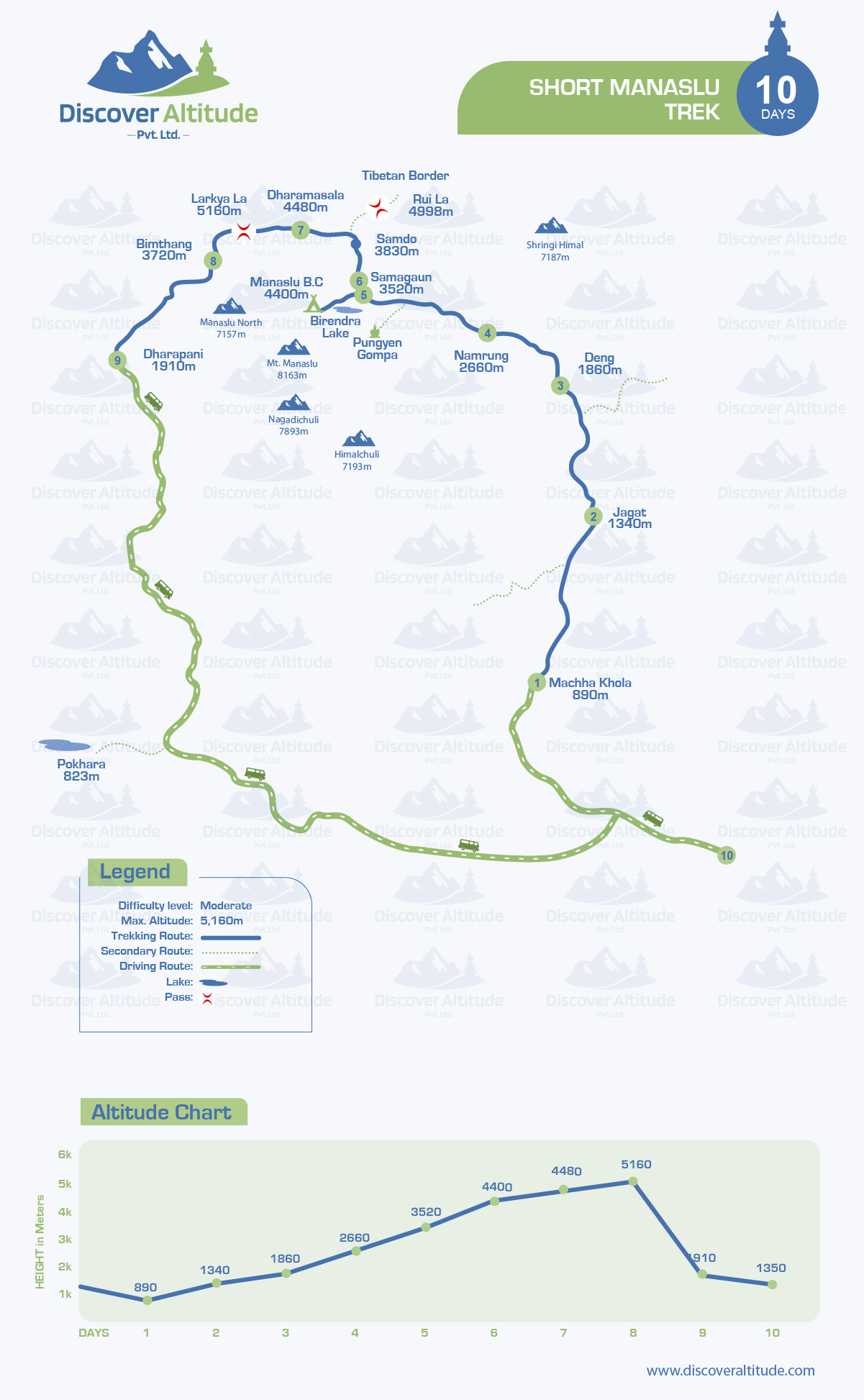
Day To Day Trekking Distance of Short Manaslu Circuit Trek:
Day 1. Kathmandu to Maccha Khola 160km (99 miles) - Drive
Day 2. Maccha Khola to Jagat 22km (13.5 miles) - Trek
Day 3. Jagat to Deng 19.9 km (12 miles) - Trek
Day 4. Deng to Namrung 19.5 km (12 miles) - Trek
Day 5. Namrung to Samagaon 17.7 km (10.9 miles) - Trek
Day 6. Sanagaon to Dharmasala 14 km (8.5miles) - Trek
Day 7. Dharamsala to Bhimthang via Larkya La Pass 23 km (14miles) - Trek
Day 8. Bhimthang to Dharapani 20.9 km (12.9 miles) - Trek
Day 9. Dharapani to Kathmandu 210 km (130 miles) - Drive
Note: If you have your group (2+), we can arrange a trip on any of your favorable date. The above-mentioned dates are for those who are looking to join a group
COST FOR SHORT MANASLU CIRCUIT TREK 10 DAYS
Note: Minimum 2 pax required for Manaslu Trek booking
(Still not satisfied with the given itinerary? Speak with an Expert at +977 9851149890 (WhatsApp) or customize the Itinerary: Customize Form )
Table of Contents
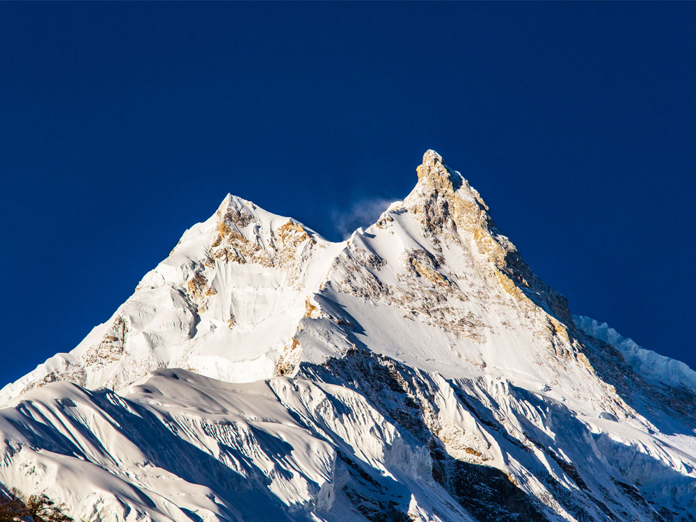
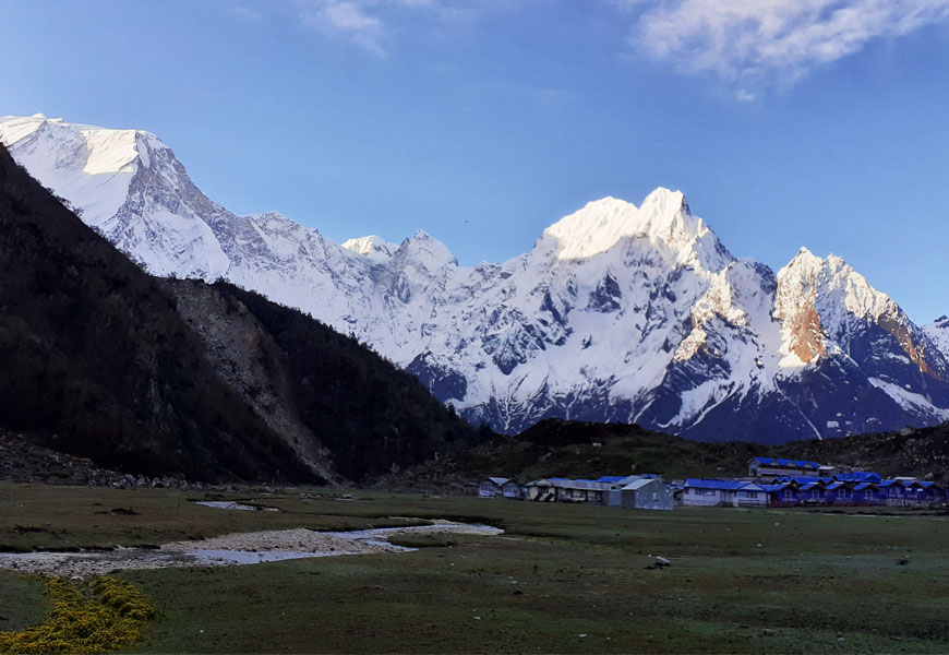
Mount Manaslu is pictured on route to Samagaun.
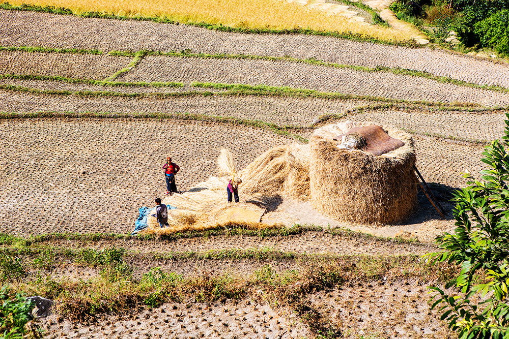
Situated in the Gorkha district, Short Manaslu Trek is one of the popular off-the-beaten trails mainly inhabited by the Gurung community, which allows us to explore the remote wilderness of the entire Gorkha district, through the ancient salt trade route towards Tibet.
Moreover, the Short Manaslu trek will assist us in exploring the diversification of the entire region, starting from lower settlers to the high Sherpa dwellers. Along with an agricultural lifestyle to animal
rearing. This diversity of settlers is followed by culture, religion, lifestyle, and tradition, and above all, biodiversity is never to be missed.
Starting the trek through farmland, one can explore rivers, valleys, waterfalls, temples, monasteries, and the Himalayas throughout the trail.
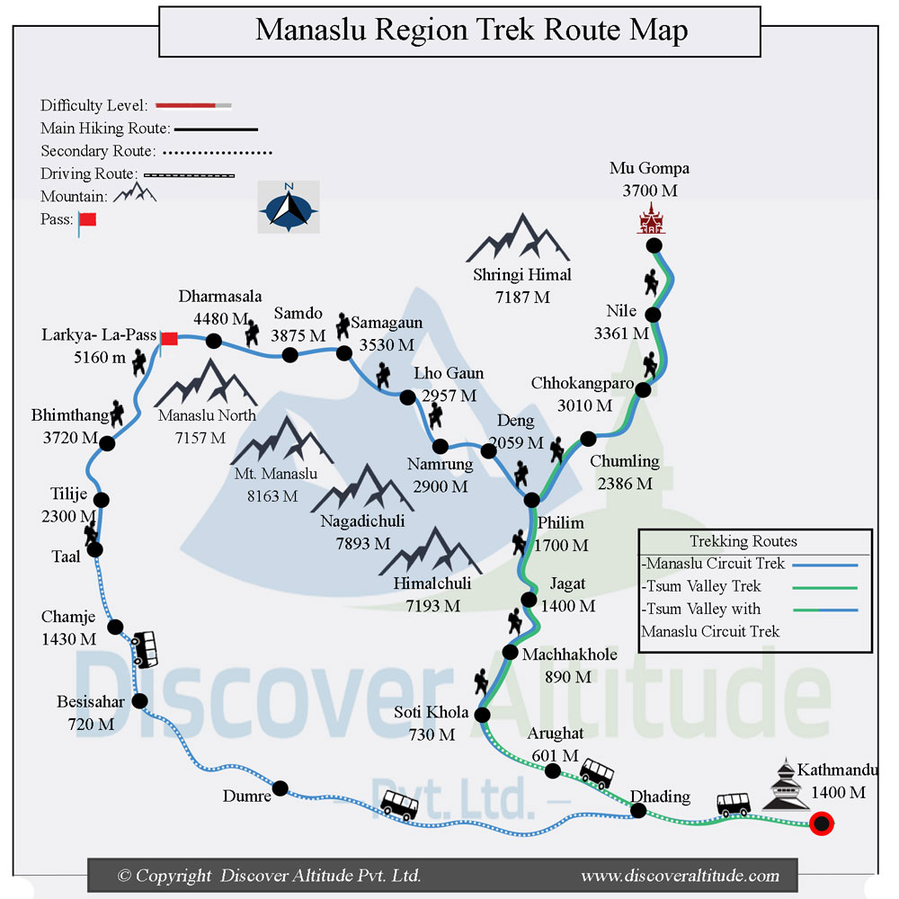
Short Manaslu Trek Map
The Short Manaslu trail will bless us with the magnificent view of Mt. Manaslu along with Mt. Annapurna, which are both the eight-thousand (ers). With increasing popularity among adventure trekkers.
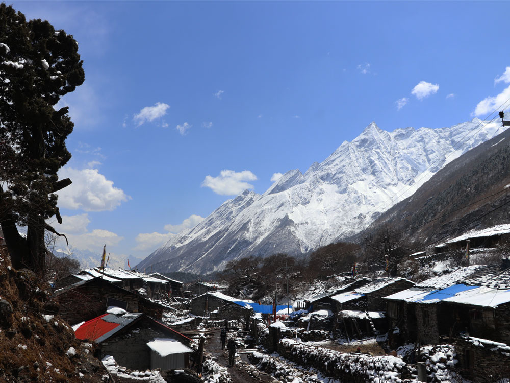
The popularity of the Manaslu trek is increasing rapidly, which leads locals to operate sufficient numbers of tea houses and lodges on the trail, and now for trekkers, there are multiple options to select their overnight camp.
Since Manaslu is a restricted area, trekkers were only permitted to enter the Manaslu area in 1991 AD, but with some restrictions, which include a special permit, not fewer than two trekkers, a mandatory government-registered trekking guide, and a permit to be granted only through a government registered trekking agency.
Whatsoever, maybe the condition Discover Altitude can arrange group joining for Short Manaslu Trek.
Highlights of Short Manaslu Trek:
Short Manaslu Circuit Trek which is only an 8-day hike from Soti Khola to Dharapani taking us to the highest Larkye La Pass (5123M), glacier, Himalayas, rivers, etc. will help trekkers to accomplish their dream of visiting the most desired trail in a short period. Further adding an extra day to the itinerary will allow us to visit Manaslu Base Camp (4900M)
The trail to Manaslu is less crowded due to its wilderness and special provisions imposed by the government of Nepal. This makes the Manaslu trek less populated and a virgin trail but it is feasible for any trekkers.
Moreover, the Manaslu trek is filled with the diverse colors of nature and culture, with two eight-thousand (ers), Larkye Pass along with two conservation areas at a time, which are Annapurna Conservation Area and Manaslu Conservation Area.
Apart from Mt. Manaslu and Mt. Annapurna, trekkers will be blessed with the magnificent views of Kang Guru, Nemjung, Himlung Himal, Gyaji Kang, Cheo Himal, etc along with the ancient monastery at Sama Gaun, and the highest pass of Larkye La (5123M)
Detailed Itinerary of Short Manaslu Trek:
Day 1: Kathmandu to Soti Khola (710M/2329Ft) 7-8 hours
The first day of our entire trek to Soti Khola will be a private jeep drive for 7-8 hours but with frequent stops. This will be a journey from Kathmandu, passing by villages, rivers, farmland, forests, etc. until we reach Soti Khola.
This will be a good time to take a rest and explore the starting point of our trail. Overnight at Soti Khola.
Day 2: Soti Khola to Machha Khola (900M/2953Ft) 6-7 hours
This will be our first hiking day, covering a distance of around 22 km, as the trail will be of lower altitude, we pass through Sal forest to take a climb at the ridge of Budhi Gandaki to reach Kausani.
Descending downhill through the rice field, we will reach the Gurung village of Labubesi. Further climbing through the rocky trail, we will be on the bank of Budi Gandaki. Hiking by the sandy river bed we ascend through the side ridge to reach Machha Khola.
Overnight at Machha Khola.
Day 3: Machha Khola to Jagat (1410M/4626Ft) 6-7 hours
As we ascend higher, the trail becomes narrow, we will make certain ups and downs throughout the trail to reach Jagat.
This will be an easy trail for us, we cross-seasonal stream called Tharo Khola to reach Khola Besi, diverting our trail with ascending and descending, we will be at the hot spring called Tatopani.
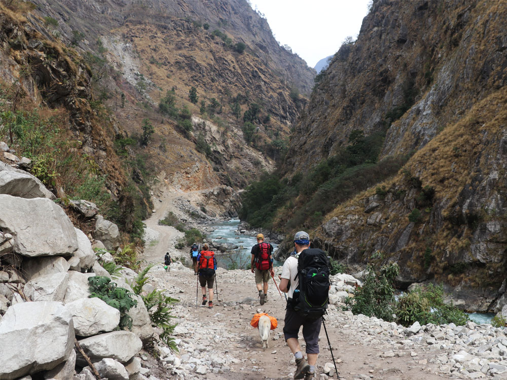
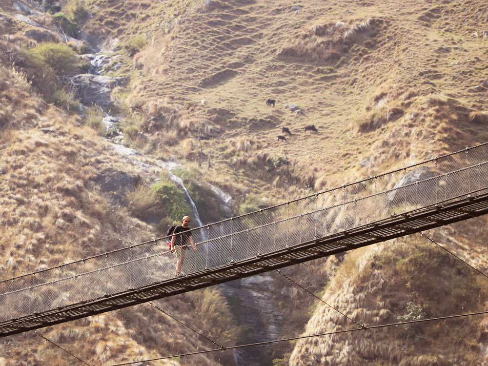
Climbing further higher, we cross by Budhi Gandaki River over the suspension bridge. Following our trail through the stone staircase, we will reach Dobhan.
Further, we will cross a suspension bridge over Yaru Khola then climb through a stone staircase to descend on the bank of the river to climb another stony stair to reach Tharo Bharyang.
From Tharo Bharyang, we cross the Budi Gandaki River before taking a climb over the ridge to reach Jagat.
Overnight at Jagat.
Day 4: Jagat to Deng (1804M/5918Ft) 6-7 hours
Today we will be ascending some 4,00M with frequent ups and downs with magnificent views of rivers, waterfalls, farmland, villages, and mountains. We follow the trail through rocky ridge upwards to Salleri before descending towards Sirdibas.
As the valley gets widens making the trail easy-going till Ghatte Khola. We continue our hike towards Gurung village crossing the suspension bridge in Philim, taking a north turn from Philim we will divert towards Ekle Bhatti.
Further, we will be descending through a grassy area to cross the Budi Gandaki River and continue the trail on the bank of the river. This will take us to pass by bamboo forest through a wide valley to reach the village of Deng after crossing a seasonal stream.
Overnight at Deng,
Day 5: Deng to Namrung (2,540M/8,333Ft) 6-7 hours
Today after breakfast we will make a climb of about 800M with frequent ascends and descends. This will be the easy trail, starting from Deng for a while to crossing the Budhi Gandaki River to reach Rana village.
Further, we will meet diverse trails, and we then follow west towards Budhi Gandaki Valley. As we continue our trail we will pass by forest and Mani walls related to Buddhism to reach Ghap village.
Here we will have the option to choose between two different trails but we follow the trail through Prok village because the village is a magnificent spot for the view of Siring Himal, taking a rest for a while we continue our trail crossing the Budi Gandaki river Several times. As we hike, we will pass by Buddhist Gompa throughout the trail.
The trail further leads us towards the dense forest to make a steady climb uphill to reach Namrung.
Overnight at Namrung.
Day 6: Namrung to Sama Gaun (3,530M/11,581Ft) 6-7 hours
From today we will enter the real Himalayas of Nepal, this will be through the open trail with less flora, allowing us to have magnificent views of the Himalayas.
We will enjoy our breakfast in Namrung with the view of Siring Himal, Ganesh Himal, and Mt. Himal Chuli.
We continue our hike upwards through the forest to reach Lihi, a small Buddhist village. Lihi is a popular Buddhist village with multiple Chortens. Passing by Lihi, we descend towards Simang Himal valley, making us closer to Ganesh Himal.
Further, we continue our trail through the Sho, Lho, and Shyla villages, which are popular villages of the Manaslu region. Who and Shyla village is also a great spot to explore the magnificent views of Himal Chuli, Peak 29, and Mt. Manaslu along with a popular Ribung monastery at Lho village.
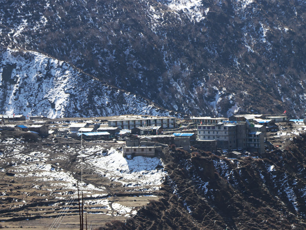
Following our trail with the splendorous view, we will be at Sama Gaun, a popular acclimatization spot to explore Manaslu Base Camp (4900M)
Overnight at Sama Gaun
Day 7: Sama Gaun to Samdo (3,860M/12,664Ft) 6 hours
Samdo is the last settlement as a permanent base before crossing Larkey la as Larkey Phedi(Bhimthang) is just a seasonal one.Samdo village from a different perspective.
We descend through the trail towards the Budi Gandaki River, crossing a bridge over a seasonal stream, we ascend a bit higher to reach the trail turning towards the Manaslu Base Camp.
We follow the trail towards the Larkey La Pass, passing by Mani walls all the way, as we hike, the trail gets widened towards the juniper and birch forest of Kermo Kharka.
Now, we descend towards the Budi Gandaki River, as we ascend higher, the river gets narrow, and we cross a wooden bridge over the river to follow the stony trail to reach Samdo.
Overnight at Samdo.
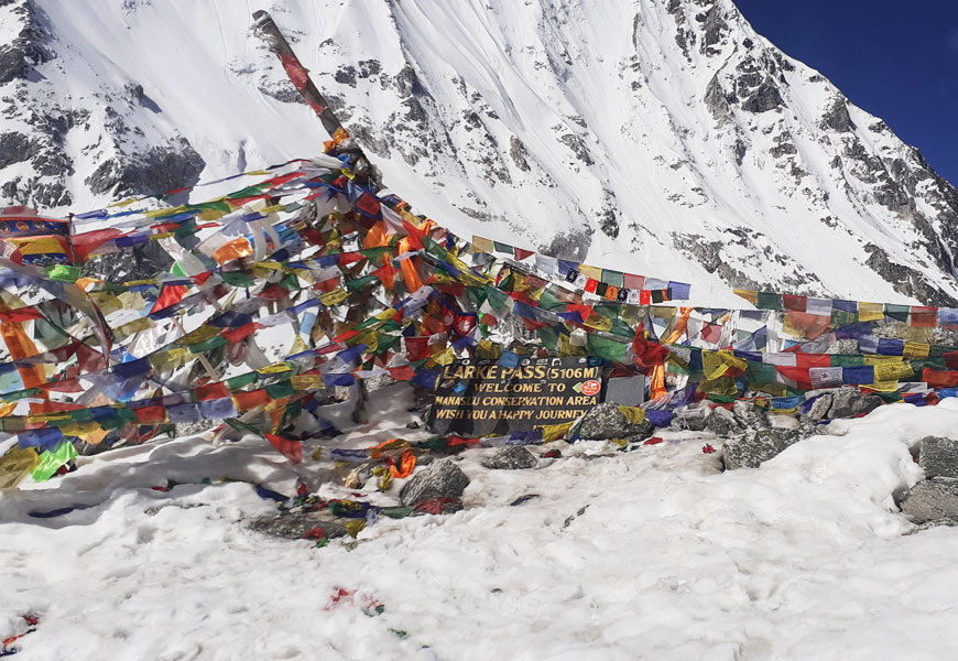
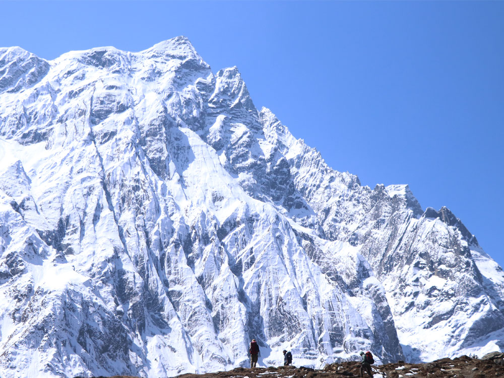
Day 8: Samdo to Bimthang (3890M/12762Ft) Via Larkya Pass (5,123M/16,808Ft/) 9 hours
The top of Larkey Pass Landmark with prayer flags where people take pictures.
This will be the hardest and the longest trail of the entire trek, now our physical fitness level will be counted. After an early breakfast, we start our hike with a short descent to cross a wooden bridge over the Budhi Gandaki River.
Further, we ascend to Larkya La Pass (5123M), this will be a fair-going trail but too high altitude. We cross by a couple of streams to have a first glimpse of the Larkya glacier, ascending higher we will have a view of Larkya Peak and Cho Danda.
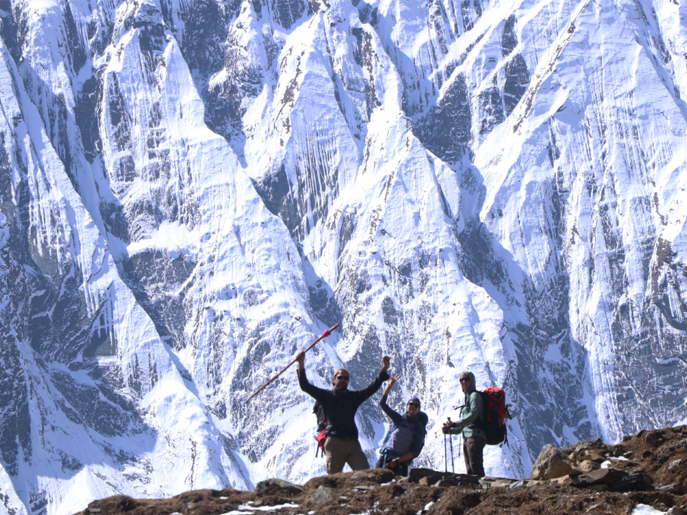
Finally, making a gradual ascent across the moraines of the glacier, we will reach the highest and the most desired destination of the entire Manaslu trek which is Larkya La Pass, a magnificent viewpoint to explore the Manaslu range of the Himalayas along with Annapurna.
Now, we descend downhill with the magnificent views of the Himalayas to reach Bimthang late afternoon.
Overnight at Bimthang
Day 9: Bimthang to Dharapani (1,860M/6,102Ft) 6-7 hours
A magnificent view of Mount Manaslu (left) and Punggi Himal (right) is pictured in the morning from Bhimthang Village, Manaslu.
Today we will be descending towards the hill from the Himalayas. We hike downhill toward Budi Gandaki Valley. Passing by green vegetation we will reach the rhododendron forest before Karcher.
Further, hiking downhill we will be at Tilje for a break. Crossing Dudh Khola and Marsyangdi rivers we will be at Dharapani.
Overnight at Dharapani.
Day 10: Dharapani to Kathmandu (1,350M/4,429Ft) 9 hours
This will be our easy day, after our breakfast, we will take a jeep drive through the valley and Marsyangdi River to reach the district headquarters of Lamjung which is Besisahar.
Finally, we get a bus to Kathmandu Valley, passing by villages, rivers, and hills.
Some Useful Information about Short Manaslu Trek:
Best Time of the Year for Manaslu Trek:
Manaslu Trek can be accomplished throughout the year but when it comes to the best time of the year or the best season of the year for Manaslu Trek. We recommend trekkers trek Manaslu during Spring or Autumn.
Spring which includes the month of February-May is the best time of the year, this is so because the temperature is neither too cold nor too hot. This is an accurate time to explore the hidden vegetation of the high Himalayas as well.
Trekkers can enjoy greenery throughout the trail, along with a clear blue sky and a clear mountain view.
Throughout the trail, there will be less snowfall, which makes the trek easy going into the Larkye La Pass and or Manaslu Base Camp.
Along with views, spring is the time to explore the Himalayan flowers throughout the trail, and the national rhododendron flower will be very attractive.
Apart from Spring Autumn is also the best time of the year for the Manaslu Trek, Autumn falls mainly from August- to November. This time of the year is also the beginning of winter in Nepal.
We will bid farewell to the monsoon, which is June and July and the second half of August brings a clean and clear blue sky all over Nepal and the Himalayas is not an exception.
Although we will miss Himalayan flowers and greenery throughout the trail to speak the truth, trekkers will enjoy the chill temperature, far and great view, along with the fauna of the mountains. In the mountains, the sky will be spotless blue, and the Himalayas shining white.
The trail will be easygoing as there will be less snow to create trouble for crossing Larkye La Pass (5,123M) or visiting Manaslu Base Camp (4,900M).
Food and Accommodation in Manaslu Trek:
Manaslu Trek is an untouched paradise of the Himalayas, it is a hidden treasure to the north of Nepal bordering Tibet.
Moreover, Manaslu is a restricted area which got opened for trekkers only in 1991 AD but with special permits and strict provisions.
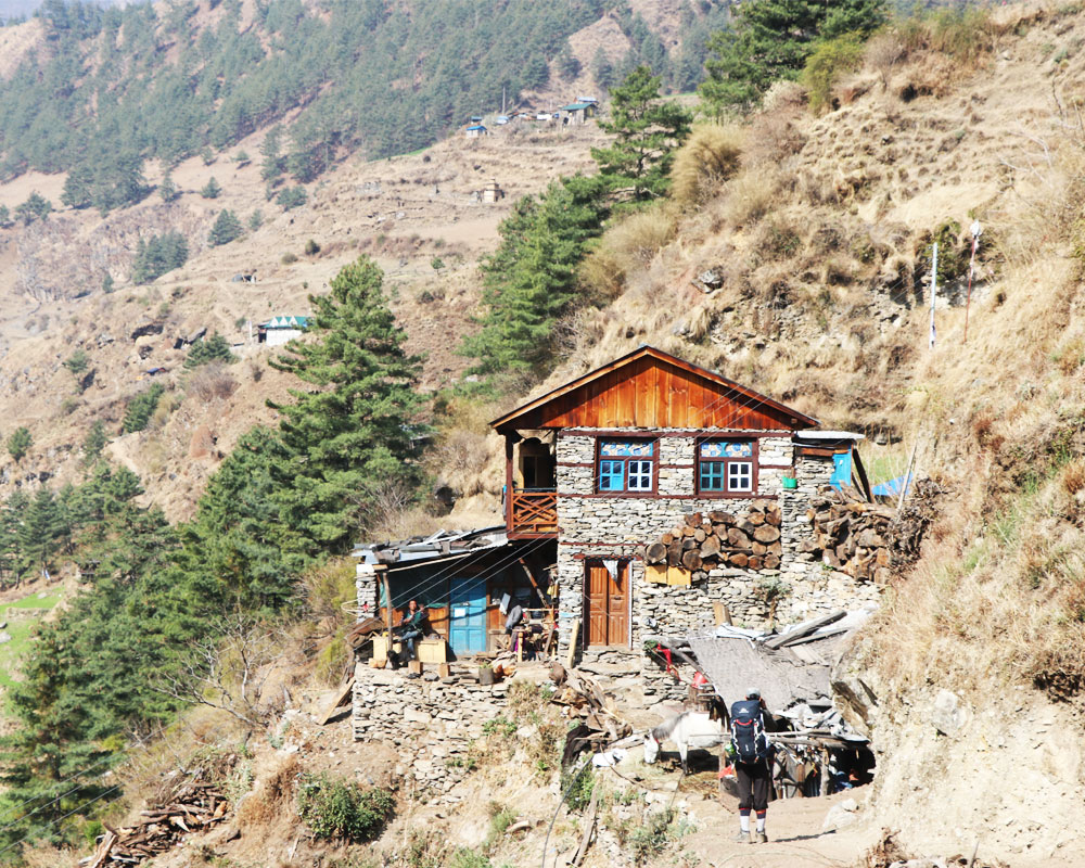
Although Manaslu is a restricted region for foreign trekkers/travelers, there are numerous local Gurung settlement villages throughout the trail.
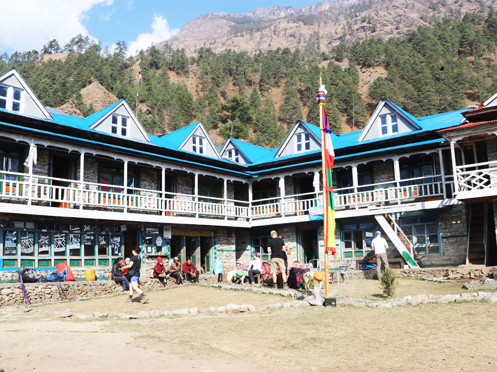
This ethnic group of people operates teahouse lodges for trekkers with basic facilities but standard enough to spend overnight and experience delicious food staff ranging from local Nepali cuisine to Chinese to Italian to Indian to Continental.
This teahouse and lodge are run by local settlers, so trekkers can experience local hospitality and feel the emotion of a home away from home.
All the teahouses and lodges will have a room with two single beds and a tea table to keep our belongings. They will provide a thick mattress for the bed, a bedsheet, a pillow, and a blanket for each bed. Some rooms might have an attached toilet, but normally they will have a common toilet on every floor.
For food trekkers can choose from the menu, foods will be hygienic and well-cooked, as the local government and Manaslu Conservation Area Project frequently conduct cooking and hospitality-related training for the local teahouse and lodges operators.
Required Permits for Manaslu Trek:
Manaslu region is a restricted region in Nepal, this region was opened for trekkers only in 1991 AD but with special provisions.
Apart from this, the Manaslu region also borders the Annapurna Conservation Area, this makes the Manaslu Trek follow two different trails of the Manaslu and Annapurna regions.
So, trekkers need to carry 3 different permits to trek Manaslu which are as follows:
Restricted Area Permit: USD 75 to USD 100 depending upon the season
Manaslu Conservation Area Project (MCAP) Permit: USD 30 or Rs.3000
Annapurna Conservation Area Project (ACAP) Permit: USD 30 or Rs. 3000
Physical Fitness for Manaslu Trek:
Manaslu trek is a moderate trek into the Himalayas of Nepal covering an altitude above 5,000 Meters, this makes the Manaslu trek a bit difficult due to the lower oxygen level. Trekkers need to hike 6-7 hours per day to accomplish the trail, but if we extend the number of days the hiking time will be reduced. This depends upon our time frame.
So, it is suggested better to maintain continuous physical fitness, prior physical training is not required but is suggested if you don’t have good stamina, having strong determination and a positive attitude towards your destination is the only mantra for the success of the entire Manaslu Trek.
Government Provision for Manaslu Trek:
Manaslu Region is a restricted region in Nepal, In 1991 AD trekkers were forbidden to enter the Manaslu region but due to global increasing interest in the Himalayas, the government of Nepal lifted the restricted provision but with certain provisions. This includes:
Trekkers into the Manaslu region must trek only with a registered trekking agency.
Trekkers must have a registered trekking guide to assist.
The number of trekkers must not be less than 2 pax.
Solo or individual trekkers are forbidden to trek the Manaslu region.
Kumar is one of the Co-founders and Managing directors of Discover Altitude holding 18 years of experience in the tourism sector of Nepal. He has trekked to almost all the popular regions of Nepal and is an authorized trekking and tour guide.
Started his career as a porter to support his study, now holds MPhil and LLB degree, and is doing his Ph.D. in religious studies. He loves traveling to the Himalayas and has deep knowledge about religion, culture, and history.
Kumar is also involved in the teaching sector as a part-timer to deliver his research related to the cultural and religious diversity of Nepal and is the one who mostly answers your queries giving them his personal touch through his decade-long experience.